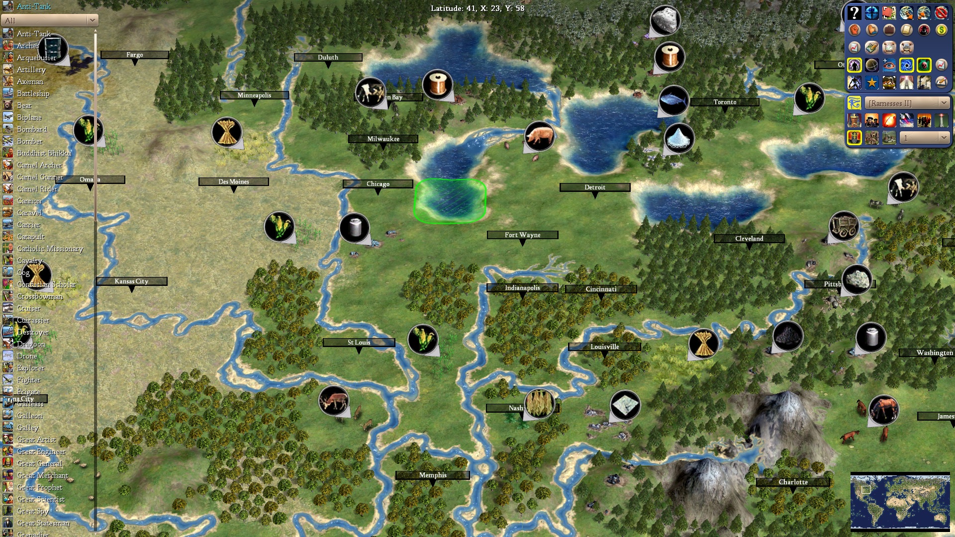
Atlanta is exactly where I'd put it. Boston should be 1SW and Washington 1N, but it makes sense to slightly move them in order to make them viable. Memphis should definitely be 1 SW. Seattle could move 1S in order to make Vancouver possible, which should go 1N of the current Seattle.
- Home
- Forums
- CIVILIZATION IV
- Civ4 - Creation & Customization
- Civ4 - Project & Mod Development
- Civ4 - Rhye's and Fall of Civilization
- Rhye's and Fall - Dawn of Civilization
You are using an out of date browser. It may not display this or other websites correctly.
You should upgrade or use an alternative browser.
You should upgrade or use an alternative browser.
[Development] Alternative Map during 1.17
- Thread starter Leoreth
- Start date
1SDANi
The Fading Memory
- Joined
- Oct 27, 2014
- Messages
- 3,103
I don't think I'd ever settle Trowulan. The city 1E of the Javanese rice just seems way better. It gives Pearls and Whales, is less crowded, allows my Core to cover more coast, and the Incense can easily be acquired by settling 2S of it in Australia, which also gives what looks like Iron, Gems, and later on Oil.
Also, I'd probably settle on the Sumatran Spices for the increased production having two hills in my BFC grants.
Alternatively to settling 1E of Trowulan, I might sometimes settle 1SE of Palembang for the bigger Capital that the fish, tea, and Palembang grassland tile grants, settle 1SW of Trowulan to cover the rest of Java, and settle 1N of the Whales to cover the pearls, whales, and incense.
For China I think I'd settle my Capital 1W of Luoyang, Lanzhou for the iron, 1E of Baotou, sneak a city 1SW of Shenyang to block the Barbarian non-coastal city spawn, settle 1SE of Qingdao for extra Core pop from the Korean Fish after I conquer them, settle Kaifeng to mop up the Wheat, Pig, and Dye, Settle Ningbo, 1SW of the Taiwanese Pearls, Changshan, 1NE Guangzhou, Dai La, 1W Dali to trade the Cow for the Jade, and Chengdu
Most of those are rolling changes from settling my Capital 1W of Luoyang and blocking non-coastal barbarian Shenyang by settling 1SW of it.
Last edited:
Many cities are not on the "right" side of the river they border.
Memphis 1SW though? That really looks like Alabama too me.
Memphis 1SW though? That really looks like Alabama too me.
MechatronicJazz
Prince
- Joined
- Aug 15, 2007
- Messages
- 316
Seattle could move 1S in order to make Vancouver possible, which should go 1N of the current Seattle.
I'd have to see more of BC on the map to know for sure, but I think Vancouver might be one tile further north than you think. It depends on whether the Fraser River is on the map and on how Vancouver Island is shaped and positioned, and how important the relative position is of Vancouver and Vancouver Island. You might be right though. Also, as much as it would be nice to see LA, San Francisco, Portland, Seattle and Vancouver at the same time, sometimes the map scale requires choosing between major cities.
Many cities are not on the "right" side of the river they border.
Memphis 1SW though? That really looks like Alabama too me.
The upper part of Alabama should be 1SE of the tile where you put Memphis. Memphis is more or less on a straight line between St. Louis and New Orleans, with the distance to New Orleans not that much bigger, giving exactly the tile 1SW of where you put it. It also really shouldn't be abjected to the Ohio river.
I'd have to see more of BC on the map to know for sure, but I think Vancouver might be one tile further north than you think. It depends on whether the Fraser River is on the map and on how Vancouver Island is shaped and positioned, and how important the relative position is of Vancouver and Vancouver Island. You might be right though. Also, as much as it would be nice to see LA, San Francisco, Portland, Seattle and Vancouver at the same time, sometimes the map scale requires choosing between major cities.
Vancouver being the major Pacific port of Canada certainly should be settled.
Many cities are not on the "right" side of the river they border.
Memphis 1SW though? That really looks like Alabama too me.
I too support Memphis 1SW. I'd also like to suggest moving Los Angeles 1N, Las Vegas 1E & my earlier addition of two tiles to New England (because New York & Pittsburgh being a tile away from one & other looks wrong to me).
Attachments
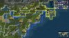
Pittsburgh and Cleveland (along with the upper part of the Ohio river) should both be moved 1W anyways, problem solved. Pittsburgh is directly south of lake Erie.(because New York & Pittsburgh being a tile away from one & other looks wrong to me).
Oh, my brain kinda short circuited when I read Memphis 1SW and somehow looked SE on the map. That makes more sense.
MechatronicJazz
Prince
- Joined
- Aug 15, 2007
- Messages
- 316
I mean, I'm from near there, so I agree.Vancouver being the major Pacific port of Canada certainly should be settled.
 But it doesn't always work out. But in any case, if this is the map, then I think Seattle is correct where Leo put it and Vancouver would be 2N and 1W, on the forested hill NW of the . You would need to choose between Vancouver and Victoria (1SW), but that feels ok. Anyway, the west coast looks pretty good to me. There could maybe be islands between Vancouver Island and mainland BC and Washington state to represent the Gulf Islands and San Juan Islands. That part of the coast is pretty much filled with archipelagos.
Tab911
Chieftain
- Joined
- Jun 20, 2019
- Messages
- 58
I went ahead and tried a pass at the US.
Starting from the northeast:
The northeast today is a densely populated economic powerhouse. In colonial times, the coast was what was most valuable. Historically, Boston, New York, Philadelphia and Jamestown were all settled as early colonies. We cannot fit them all so I'd opt for Boston, New York and Washington as these cities remain important today in academics, finance, and politics respectively. It's important to have plenty of food resources while also leaving tiles open for villages and towns.
Tile changes-
Hill has been added south of Montreal. In real life the area is a plateau highland and provides defense for US or Canada (battle of Plattsburgh). I'd like to add a river to represent Lake Champlain and provide more commerce between NY and Montreal.
Resources- Crabs off of Boston represent lobsters, whale has been placed off of Cape Cod in order to influence Boston's city placement. I put deer in Vermont as it is littered with them and provides additional food for New York or Boston. Aluminum has been placed south of Montreal as a late game production resource, the area was rich in aluminum to the point that it poisoned Lake Champlain for a time.
For New York, I placed clam and fish in the harbor for additional food growth. The fish should always be available to represent Long Island's fishing tradition while the clam can spawn in later to provide additional food and health. Cows have been placed 1nw to represent upstate's dairy production. Iron has been placed 2w representing western Pennsylvania's rich steel history and providing production.
I moved Washington 1n to more accurately reflect its location, it could also be 1s so as to not crowd NY. Crabs have been added in the water as the Chesapeake is famous for them and horses 1w provide production in northern Virginia. 2s is tobacco, and I feel very strongly about it. Its still produced in Virginia today and was a primary reason that Jamestown was founded in the first place. I left the stone where Pittsburgh was placed but it probably should be swapped with the iron 1n. Finally coal and aluminum dot the hills to represent the mining history of West Virginia. I chose aluminum so it would be available in the core but I'm starting to think copper would be more appropriate.
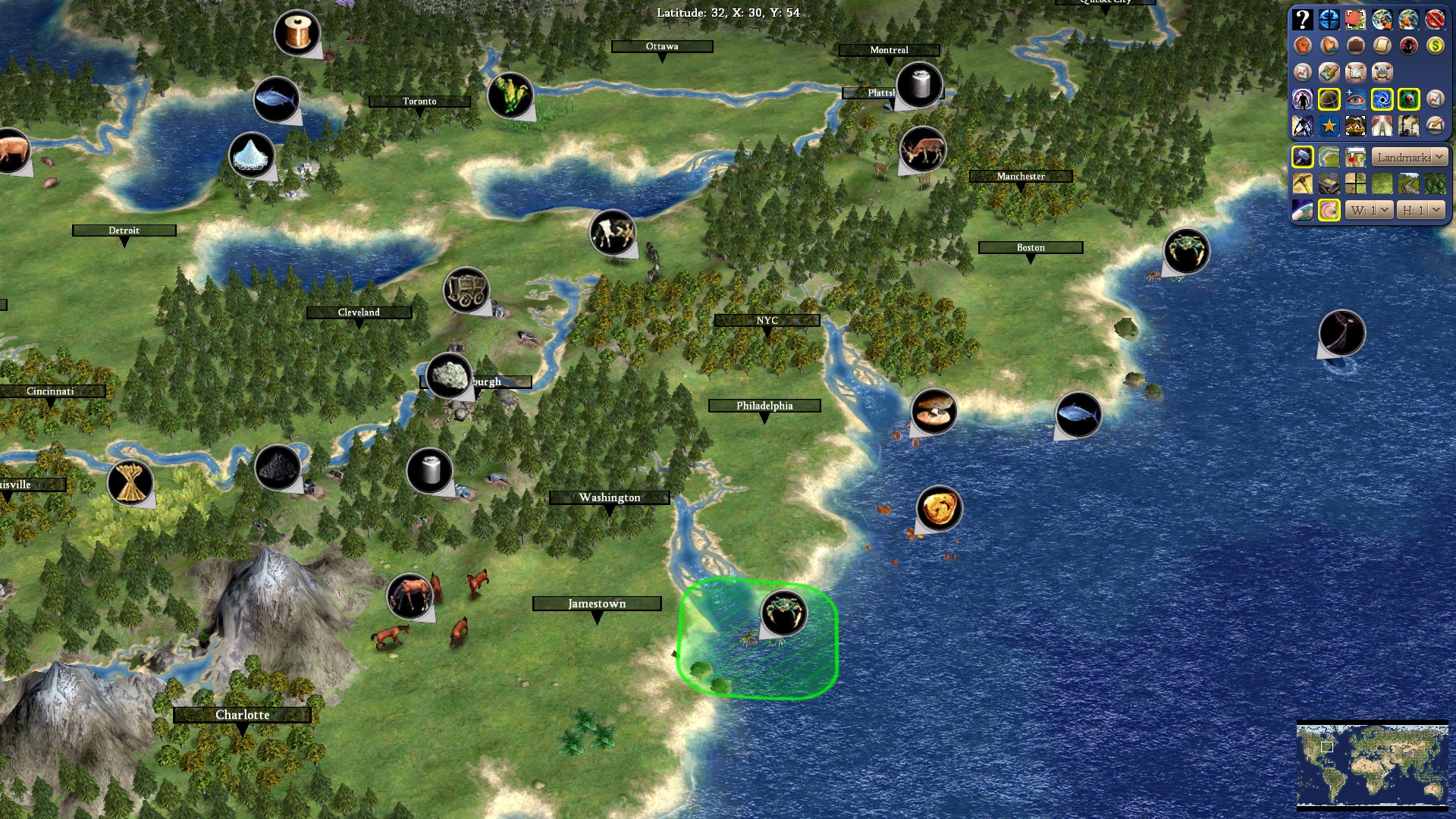
Southeast:
The south became an immensely profitable region of the US early on. It's downfall during the Civil War was that it lacked the production ability that the north had. The historically important cities are New Orleans, Savannah, Charleston and Memphis while today Atlanta and Charlotte are.
Tile changes-
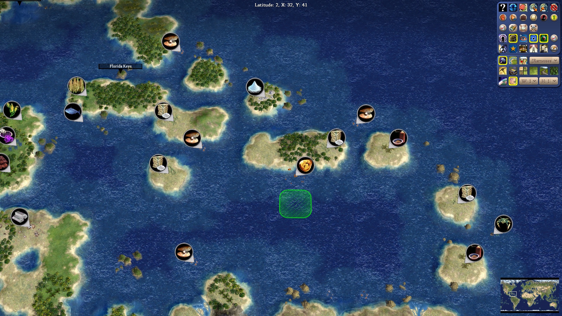
Florida- Florida was a Spanish territory until 1819 and didn't really become important until the mid 20th century. The two jungle tiles didn't really fit so I swapped them to better represent the Everglades. I made the other two tiles marsh making the peninsula useless until later eras. Visible in the Caribbean screenshot is the Florida Keys, and island chain immediately south of the southernmost tile. It allows Havana to generally control the Florida territory which is historically accurate given that the US took Florida after invading Cuba.
Carolina- Outer Banks island chain added off of North Carolina, it compliments the east coast and it's where flight was pioneered by the Wright brothers. I thought it belonged.
New Orleans- Rain-forest placed 1w to build the Bayou aesthetic
Resources- Most important one here is rice. I removed the deer that have been carried over since RFC as there isn't any sort of significant hunting in western South Carolina. Replacing the food is rice which should spawn in 1600. Rice was an integral slave crop of the early south, hence brands like "Carolina" and "Uncle Ben" rice today. I placed another tobacco 1e of the rice. The region (Ever heard of "Winston-Salem" cigarettes) is heavily agrarian and the extra tobacco allows for trading. Clam is 1e of Charleston, I moved it closer so as to also support Savannah if settled.
This placement for Atlanta is most accurate when compared with other cities and also allows it to grab some production resources which is fitting as Atlanta was one of the more industrialized cities of the south. I've added cotton 1s and 1w of Atlanta representing the plantations of Georgia and Alabama that made Atlanta the "cotton kingdom."
Geographically Memphis should be 1w but it sits on the East bank of the Mississippi so I left it. It was a rich river town in its heyday and if settled can access tobacco, cotton and plenty of food.
New Orleans was always a valuable port from its founding. 1e I placed crab representing the popular crawdads in Cajun cuisine, perhaps clams should be added to represent shrimp as well. The salt from New York has been moved 1ne in Alabama/Mississippi as they are a significant salt producer today. I believe the cow 1nw spawns after colonization if not, it should as it represents Louisiana's slaughterhouses and provides food. I think a production resource is needed but I don't want to overuse horses.
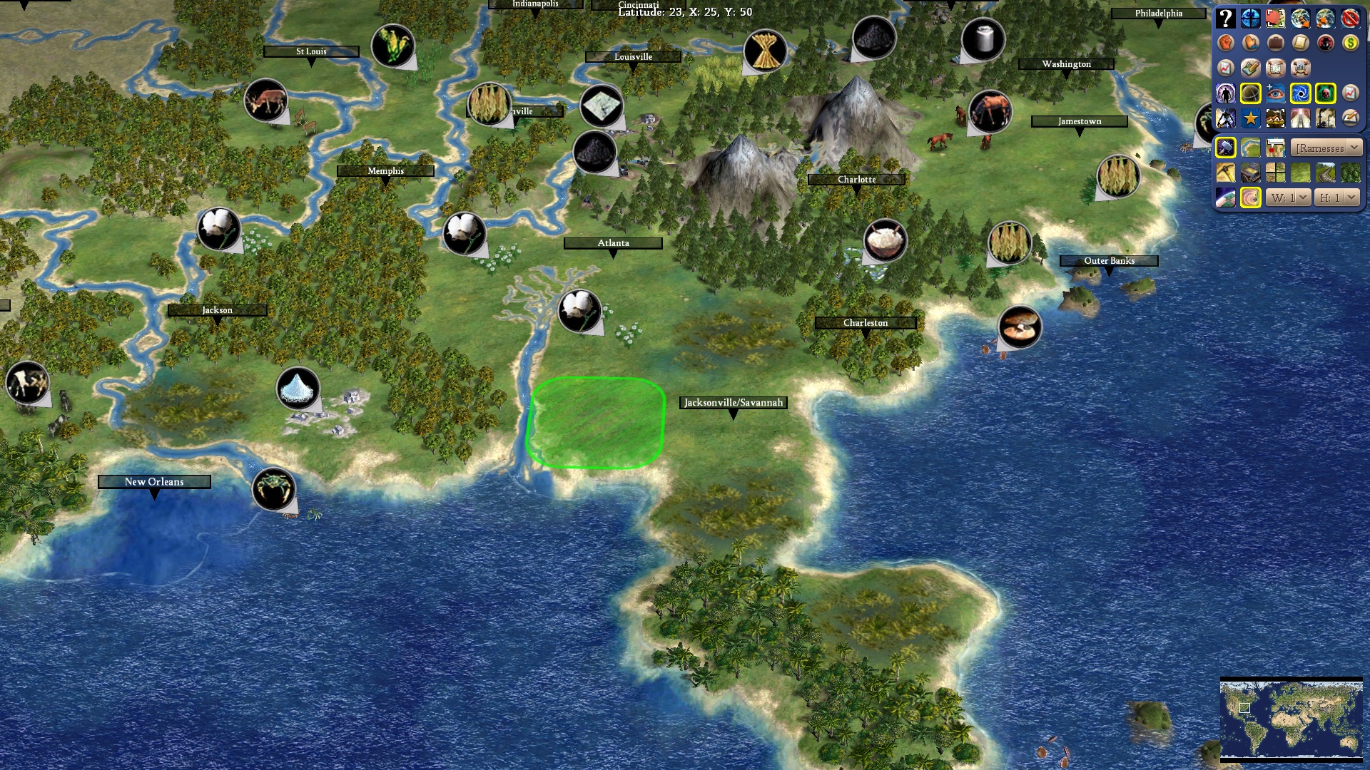
South Central:
Without resources, this area is pretty barren which is perfect as Texas didn't become valuable until after the Civil War. Today it's oil-rich, and a predominant ranching capital of the US. Important cities are Dallas, San Antonio, Austin and Houston. I moved Dallas 1n but it could be 1s. 1s seems too far from the Red River for me and it also crowds Austin/ Houston.
Tile changes-
Jungle south of Houston replaced with forest. The jungle doesn't fit the climate, actually, the grassland tile doesn't either. This area of Texas is ranches and flat plains, it should be another cow on plains. The addition of the semi desert works well for western Texas and New Mexico. These areas are more dry brush rather than sandy dunes.
Resources- Removed the fish off Houston and added oil. Houston has never been a seafood town but the football team used to be called the "oilers." Houston needs a workable oil tile in its harbor to represent its gulf shore drilling industry. It could be moved to be worked by New Orleans as well for players that want alternate city placement. Oil has also been added 1nw of Dallas as this area is a rich oil producer in real life. Deer have been moved to 1w of Shreveport, represents hunting in northern Texas. Corn placed 1sw of that to provide food for southern city. Finally, pigs, horses, cows and sheep have been placed around Dallas as Texas is a leader in ranching for all of these animals. Other than the deer and corn, none of these resources should spawn until 1800.
Midwest, North Central, Caribbean and Pacific coming up next...
Tab911
Chieftain
- Joined
- Jun 20, 2019
- Messages
- 58
Midwest:
The Midwest is the "breadbasket" of the US. It is characterized by a densely populated industrial rust belt and plentiful food resources. The key here is to place accurate resources for the main cities while keeping rust belt areas open for core towns and villages.
Tile changes-
I don't know why Chicago and Milwaukee were changed to plains but they are more accurately represented by grassland. I filled in plains west of the Mississippi which better represent Iowa.
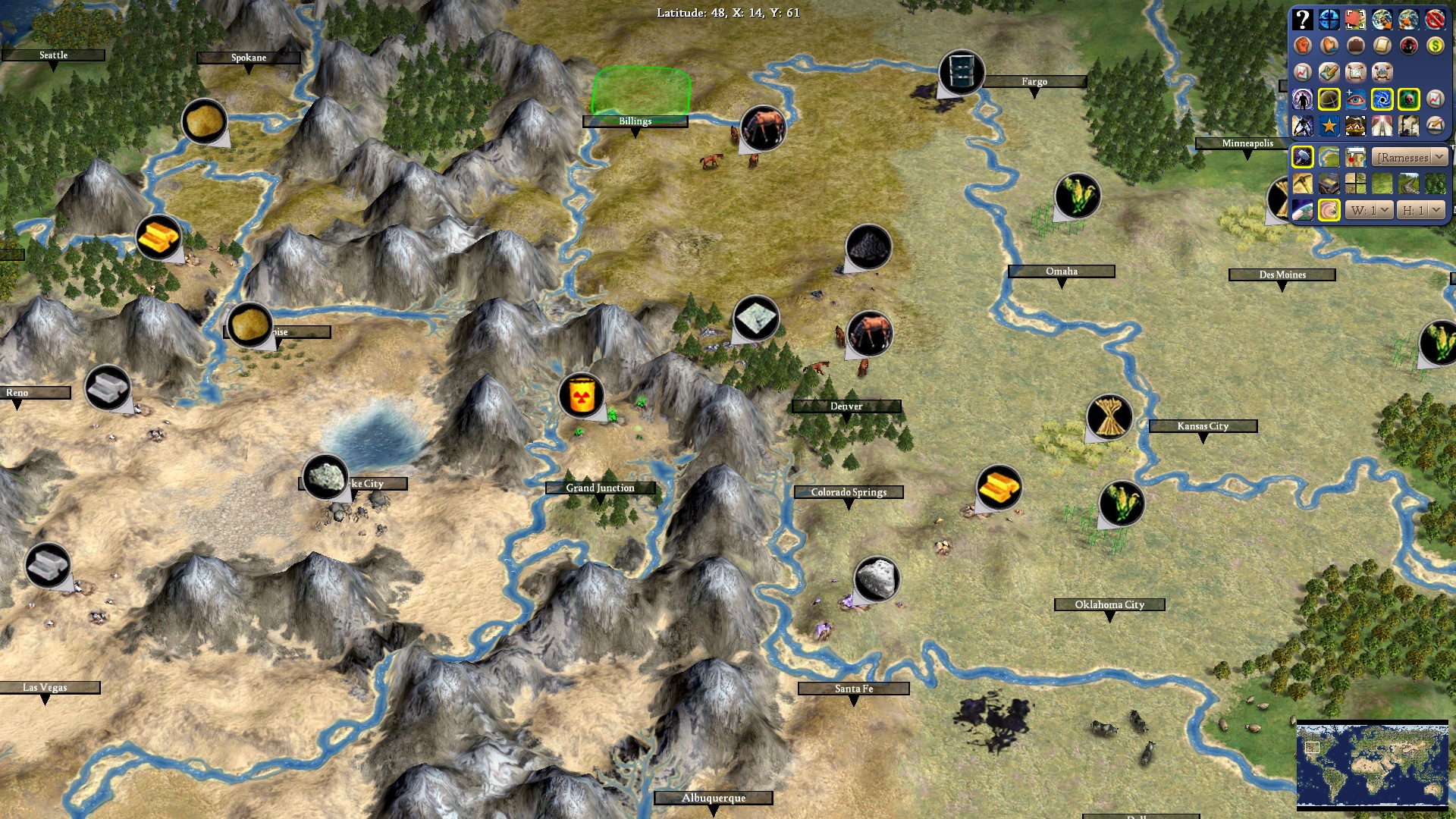
Resources- Moved copper from 1ne from Duluth to 1ne from Milwaukee. Michigan's upper peninsula had copper dating back to American Indian times and provides production for Chicago or Milwaukee. Added pigs 1nw of Detroit to provide food and allow for villages in the more populated rust belt. Cow added 1n of Milwaukee representing Green Bay's dairy obsession. Wheat added 1s from Minneapolis allows distilleries in this beer-rich region. Corn swapped from Chicago tile to 1sw for aesthetic purposes. Fits Iowa being a leading corn producer as well. Louisville wheat added 1e for Kentucky bourbon and food. Corn also added 1n of Omaha and oil 1w of Fargo. You can see corn and wheat west of Kansas City but these were added to serve Denver.
Speaking of Denver...
North Central:
The American prairie is very flat and was mostly barren before mechanized farming. It needed to be attractive enough to expand west but none of these cities are particularly major except for Denver. I also want to get that wild-west aesthetic as America expands into the Rockies.
Tile changes-
Steppe tiles now run down from Canada through the Dakotas, Montana, Idaho and Wyoming. Semi-desert has been added on the uranium 2w of Denver as well as 2n, 2n1w and 3n2w of Salt Lake City. Grand Junction is now plains and has a forest along with Denver and 1nw of Denver.
Resources- Horses 1e of Billings, homage to ranching in Montana and provides a city to fill out the border. Could also go with Sioux falls 1s of the oil which can reach the horse and build Rushmore. Gold moved to 1se of Denver while coal is added 2n to represent Wyoming's clean coal. I put horses 1n of Denver but it might not need them. Idaho potatoes have been added 2n1w of Salt Lake City and 1s of Spokane. Nevada "the silver state" now has silver added 1w of Reno and 1n of Vegas.
The Midwest is the "breadbasket" of the US. It is characterized by a densely populated industrial rust belt and plentiful food resources. The key here is to place accurate resources for the main cities while keeping rust belt areas open for core towns and villages.
Tile changes-
I don't know why Chicago and Milwaukee were changed to plains but they are more accurately represented by grassland. I filled in plains west of the Mississippi which better represent Iowa.
Resources- Moved copper from 1ne from Duluth to 1ne from Milwaukee. Michigan's upper peninsula had copper dating back to American Indian times and provides production for Chicago or Milwaukee. Added pigs 1nw of Detroit to provide food and allow for villages in the more populated rust belt. Cow added 1n of Milwaukee representing Green Bay's dairy obsession. Wheat added 1s from Minneapolis allows distilleries in this beer-rich region. Corn swapped from Chicago tile to 1sw for aesthetic purposes. Fits Iowa being a leading corn producer as well. Louisville wheat added 1e for Kentucky bourbon and food. Corn also added 1n of Omaha and oil 1w of Fargo. You can see corn and wheat west of Kansas City but these were added to serve Denver.
Speaking of Denver...
North Central:
The American prairie is very flat and was mostly barren before mechanized farming. It needed to be attractive enough to expand west but none of these cities are particularly major except for Denver. I also want to get that wild-west aesthetic as America expands into the Rockies.
Tile changes-
Steppe tiles now run down from Canada through the Dakotas, Montana, Idaho and Wyoming. Semi-desert has been added on the uranium 2w of Denver as well as 2n, 2n1w and 3n2w of Salt Lake City. Grand Junction is now plains and has a forest along with Denver and 1nw of Denver.
Resources- Horses 1e of Billings, homage to ranching in Montana and provides a city to fill out the border. Could also go with Sioux falls 1s of the oil which can reach the horse and build Rushmore. Gold moved to 1se of Denver while coal is added 2n to represent Wyoming's clean coal. I put horses 1n of Denver but it might not need them. Idaho potatoes have been added 2n1w of Salt Lake City and 1s of Spokane. Nevada "the silver state" now has silver added 1w of Reno and 1n of Vegas.
Tab911
Chieftain
- Joined
- Jun 20, 2019
- Messages
- 58
Southwest:
California's case is rather bizarre. Today it is a leading agricultural and cultural producer globally and has more people than Canada. The bay area and Greater Los Angeles are both mega cities of global importance. Yet California comes from humble beginnings, it was never settled in a major way by American Indians and it wasn't prized by Spain or Mexico. To solve this, I don't think any of the resources apart from minerals should spawn until 1860.
Tile changes-
San Francisco and the southern central valley has been changed to plains to reflect its Mediterranean climate. I've changed the mountain 1nw of LA to a semi desert hill. While the mountain added a nice texture to the Sierras, I've driven from LA to Vegas and its not nearly as mountainous as the rest of the Sierras. Semi desert has been added 1n and 1w of LA, 1nw, 3s, and on Pheonix and blended into the Sonora desert on the silver in Mexico. That last tile in Baja California is a plains while 1n, 4n and 2n1w are semi desert.
Resources- Silver in Mexico, location doesn't matter but we need to add one more. Mexican silver was world famous and historically important as a trading currency through the colonial age. Clams added 1sw and fish 2w of LA to provide coastal food. I placed horses 1e of LA to represent ranches and drive production. Cows have been added 1n to represent methane pollution the central valley. Rare earth minerals placed 1s of San Francisco, this is geographically more wineries but represents silicon valley. I'm thinking it should be changed to wine now though. This is Salinas where "Grapes of Wrath" takes place and wine country today, it's a good spot for it if we swap another resource in the Napa Valley. Speaking of the Napa Valley, you can see the Wine 1e of SF and the citrus 1se representing the Central Valley's fruit and nut production. Finally rice 1 nw fits as California grows rice and the bay area is huge in population. I figure to have lumber mills up north as most of northern California is wooded... and burning... but I'm thinking we need another production resource. I think the fish was always there but if not, SF needs fish.
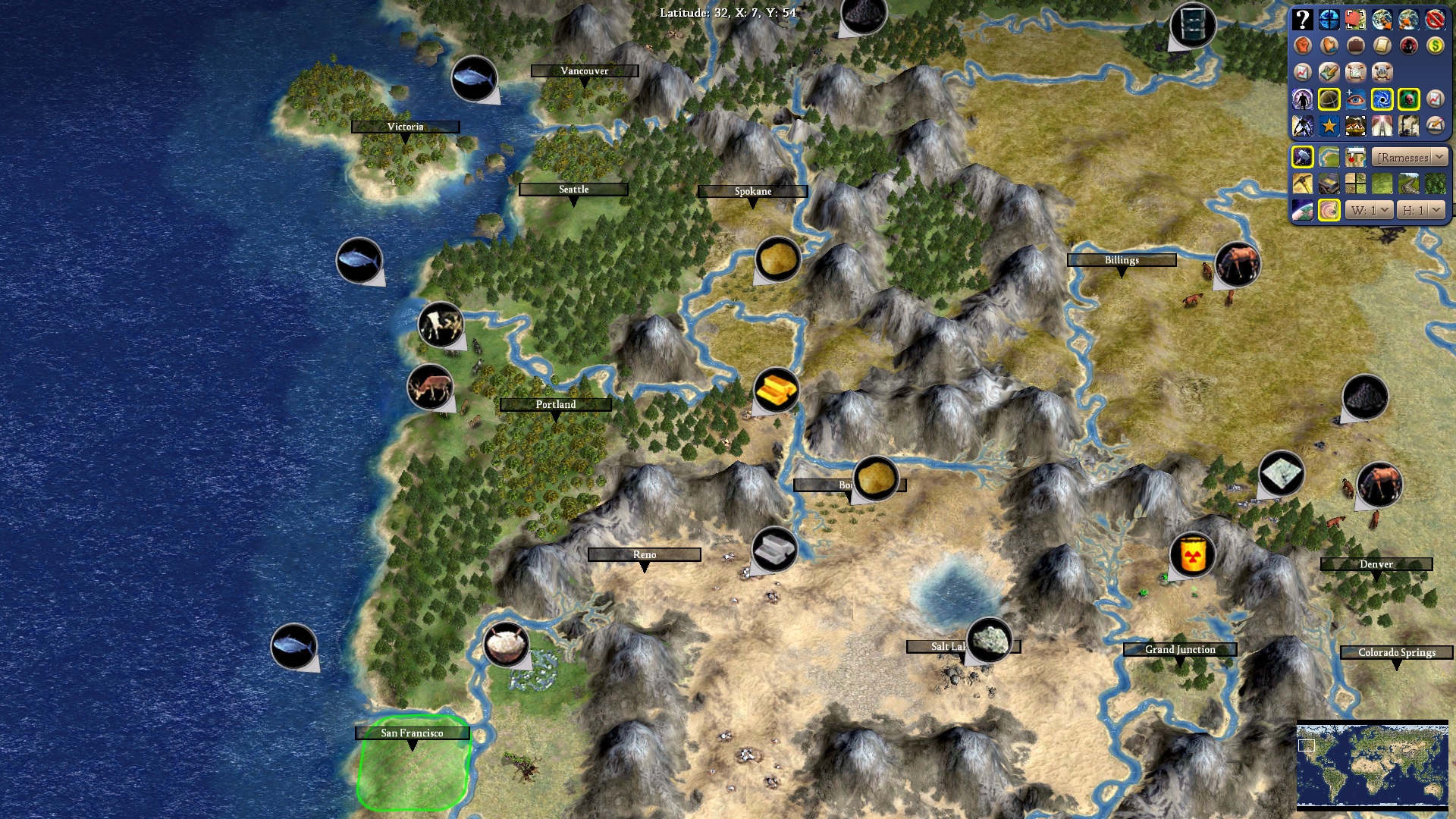
Northwest:
Unlike California, the Pacific Northwest was settled by American Indians and American Pioneers. The area should be naturally more attractive than California before any spawning resources. Today Portland, Seattle and Vancouver are all important cities, but none are quite as big as California. I tried to spread resources out so that no one could found one Pacific Northwest mega city.
Tile changes-
My biggest changes occur here. The curve on the Pacific coast felt too sharp, and Seattle and Portland didn't have enough space. Further, Portland is not actually a port and by extending the coast and altering the Columbia River 1n, I think this is a more faithful recreation. Everything between Portland and 2n of Vancouver has been pushed out by one tile. I also chose to make Vancouver Island an island and fill the straight of Georgia with smaller islands. The islands look much more accurate on 1w and 1nw of Seattle and 1n and 2n from Victoria. It still blends into Alaska quite well and actually looks more like North America on the continent map. 1nw and 2nw of Vancouver is now Moorland hills but perhaps 1nw should be grass with a deer. Steppe has been added on Spokane, 1s, 2s and 2n of Boise. Portland is flat, 1s, 1sw, 1w are hills. Seattle is on a hill, 1s, 1sw are hills while 1n is flat.
Resources- I placed gold 2w of Portland, makes the inland settlement attractive and Oregon is also a gold producer. Deer 1w provide food and cow 1nw spawns later to represent Tillamook dairy. Fish 2nw aren't reachable but they should be moved another tile north to prevent settlement 1n of Portland. Fish placed 1w of Vancouver and perhaps deer 1nw too. Idaho Potatoes are placed 1s of Spokane. I'm thinking that Beaver 1ne of Seattle should also be added for Canada and US to fight over.
Caribbean:
The name of the game here is adding sugar. I'm not sure if any spawn in later but here's what I've added.
Resources- Put spice on Trinidad (southernmost island) Trinidad and neighboring Grenada are a prominent nutmeg producer and have more of a history of spice cultivation than sugar plantations. Moving northwest, I've added sugar, left spice, added sugar for the Dominican republic, added sugar for Jamaica and added sugar on Cuba.
That's everything for now, the new map and new terrains are exciting stuff, hopefully this gets us closer.
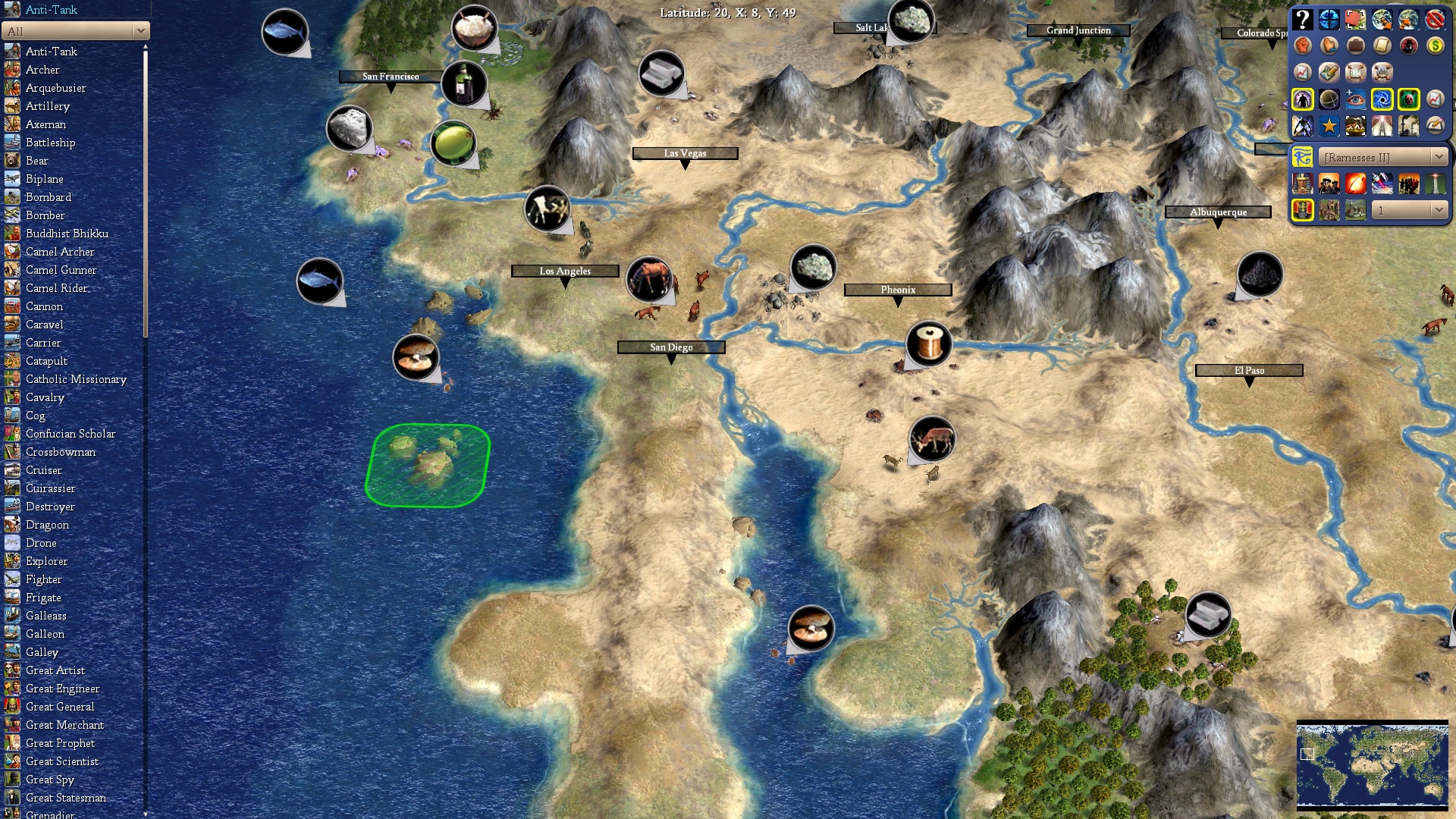
California's case is rather bizarre. Today it is a leading agricultural and cultural producer globally and has more people than Canada. The bay area and Greater Los Angeles are both mega cities of global importance. Yet California comes from humble beginnings, it was never settled in a major way by American Indians and it wasn't prized by Spain or Mexico. To solve this, I don't think any of the resources apart from minerals should spawn until 1860.
Tile changes-
San Francisco and the southern central valley has been changed to plains to reflect its Mediterranean climate. I've changed the mountain 1nw of LA to a semi desert hill. While the mountain added a nice texture to the Sierras, I've driven from LA to Vegas and its not nearly as mountainous as the rest of the Sierras. Semi desert has been added 1n and 1w of LA, 1nw, 3s, and on Pheonix and blended into the Sonora desert on the silver in Mexico. That last tile in Baja California is a plains while 1n, 4n and 2n1w are semi desert.
Resources- Silver in Mexico, location doesn't matter but we need to add one more. Mexican silver was world famous and historically important as a trading currency through the colonial age. Clams added 1sw and fish 2w of LA to provide coastal food. I placed horses 1e of LA to represent ranches and drive production. Cows have been added 1n to represent methane pollution the central valley. Rare earth minerals placed 1s of San Francisco, this is geographically more wineries but represents silicon valley. I'm thinking it should be changed to wine now though. This is Salinas where "Grapes of Wrath" takes place and wine country today, it's a good spot for it if we swap another resource in the Napa Valley. Speaking of the Napa Valley, you can see the Wine 1e of SF and the citrus 1se representing the Central Valley's fruit and nut production. Finally rice 1 nw fits as California grows rice and the bay area is huge in population. I figure to have lumber mills up north as most of northern California is wooded... and burning... but I'm thinking we need another production resource. I think the fish was always there but if not, SF needs fish.
Northwest:
Unlike California, the Pacific Northwest was settled by American Indians and American Pioneers. The area should be naturally more attractive than California before any spawning resources. Today Portland, Seattle and Vancouver are all important cities, but none are quite as big as California. I tried to spread resources out so that no one could found one Pacific Northwest mega city.
Tile changes-
My biggest changes occur here. The curve on the Pacific coast felt too sharp, and Seattle and Portland didn't have enough space. Further, Portland is not actually a port and by extending the coast and altering the Columbia River 1n, I think this is a more faithful recreation. Everything between Portland and 2n of Vancouver has been pushed out by one tile. I also chose to make Vancouver Island an island and fill the straight of Georgia with smaller islands. The islands look much more accurate on 1w and 1nw of Seattle and 1n and 2n from Victoria. It still blends into Alaska quite well and actually looks more like North America on the continent map. 1nw and 2nw of Vancouver is now Moorland hills but perhaps 1nw should be grass with a deer. Steppe has been added on Spokane, 1s, 2s and 2n of Boise. Portland is flat, 1s, 1sw, 1w are hills. Seattle is on a hill, 1s, 1sw are hills while 1n is flat.
Resources- I placed gold 2w of Portland, makes the inland settlement attractive and Oregon is also a gold producer. Deer 1w provide food and cow 1nw spawns later to represent Tillamook dairy. Fish 2nw aren't reachable but they should be moved another tile north to prevent settlement 1n of Portland. Fish placed 1w of Vancouver and perhaps deer 1nw too. Idaho Potatoes are placed 1s of Spokane. I'm thinking that Beaver 1ne of Seattle should also be added for Canada and US to fight over.
Caribbean:
The name of the game here is adding sugar. I'm not sure if any spawn in later but here's what I've added.
Resources- Put spice on Trinidad (southernmost island) Trinidad and neighboring Grenada are a prominent nutmeg producer and have more of a history of spice cultivation than sugar plantations. Moving northwest, I've added sugar, left spice, added sugar for the Dominican republic, added sugar for Jamaica and added sugar on Cuba.
That's everything for now, the new map and new terrains are exciting stuff, hopefully this gets us closer.
While you've put in a lot of great work, at first glance there's a lot of places where I would NOT settle the named city. I'll highlight the main ones:
- The Northeast and East Coast in general is pretty much without issue and I'd settle most of the named spots. The only exceptions are Washington 1S and Boston 1NE (this one dependent on core) to decrease crowding and maximize tile coverage.
- Detroit is a mediocre city and its only merits would be to snipe tiles from Canada to add core population. Based on the named spots I would settle Chicago and Cincinnati instead.
- Would never settle Denver rather than Colorado Springs; losing river access and oil in exchange for some non-resource tiles is a guarantee to not settle.
- Would settle LA 1 NW to get on river. Only loses the Desert stone while gaining river.
- Would settle San Fran 1 N.
- There is a Pacific "supercity" 1 S of Seattle - 4 food resources while reducing crowding w/ Canada.
- Salt Lake City is good on its spot but settling on Stone is a bit of a feels bad.
Tab911
Chieftain
- Joined
- Jun 20, 2019
- Messages
- 58
Appreciate the feedback! I’ve changed my mind about Washington, if the 1e is south Jersey than it really ought to be 1s.
You’re right about Boston too, I fear removing the core from NH an ME is the only way to get a proper Boston. Either that or extending New England a tile east which looks a bit odd.
In regards to Seattle, I’m alright with that, 1s is Tacoma which is still in the metro area. I reckon to move the cow 1s (Tillamook is west of Portland) and move the deer 1s. That might better incentivize a true Seattle and a Portland.
The Stone on Salt Lake could move 1w, with the Potatoes in Boise, it could sustain a population to work a couple tiles (stone and silver).
Cincinnati is a good choice, its actually a fairly important city historically so I have no qualms. Detroit is really exactly what you said, meant to add core pop and snipe Canadian lake tiles.
Perhaps with Denver I move the food sources north. If the choice was corn or oil, and you can already get oil with Dallas, would you be incentivized to go with Denver?
Not sure what to do about SF and LA, if I move the fish south to keep SF, it only incentivizes a nw LA mega city. As for LA, well it’s already got a river (it’s concrete, no trade routes, just sewage) perhaps clams go 1e?
Enyavar
Prince
- Joined
- May 16, 2015
- Messages
- 517
Hi, I was randomly checking the new map for things that I believe could use refinement. Not all are map related, though. Just a plethora of things I thought about when scrolling across the new map.
- Will roads enable troops passing through desert and tundra? Otherwise, some areas of the map will be cut off. To discourage desert road-building, road build time could be doubled for "impassible" areas.
- The floodplains in Egypt are great, but too much. Even populations of 1 and 2 would have health issues right from the start. There should be some patches of the Nile where there are no floodplains, in the version of the map I see now, every riverbound desert tile north of the Elephants is a floodplain. Hm, and another copy of the Elephants could be further north and later die out. Just like the upper mesopotamian Elephants.
- I love Mount Sinai where it is. Looks very reasonable, seeing Jerusalem where it is.
- With the new map, the very ancient times need to be more drawn out. ~35 turns cover 1000 years, that is ridiculous, especially considering the bigger map. If at least additional 50 turns can be put into the time between 3000BC and 1AD, that would be great.
- Babylon shouldn't start in 3000 BC, they are rather for 2000 BC. Check it out: Ancient middle east 1900 BCE, where the city of Babylon was still in the shadow of the larger cities to the south, like Isin and Larsa. The centuries before had already seen the Akkadian Empire, and much earlier the squabbling Sumerian city states. Although, we could start with "Sumerian City States" in 3000, rename them to "Akkad Empire" around 2300, rename them to "Babylon" around 1800, rename them to "Karduniash" or "Kassites" around 1600, rename them to "Babylonia" in 1200. Eventually, after partial collapses and vassalization to Assur they can respawn as THE "biblical" Babylonian Empire (Chaldeans) in 650 BC. Anyway, here's the full map series. I'm sorry it's German, but names should be recognizable for an English audience, I hope.
- Will Opium be fully accessible with Calendar? I would at least delay that resource until Medicine! Also, make Opium a required resource to build Alamut, I'd say. And, are some of the Opium plots put into the 3000 BC map just to symbolize where they will be discovered later in the game? Because I think that the 3000 BCE amounts of Poppy are bit too many, like the ones in Central Asia. Some should pop up later. And I assume, there will be a Cocain variant in South America?
- Maybe Jade and Marble are only discovered with Masonry? Shouldn't matter much though. Wait, there are only 2 Obsidian resources? Are they custom-made replacements of Iron, for the Mezoamerican indigenes?
- Speaking of technologies, the "cement" technology is pretty odd, if you think about it. It makes sense in the mediterranean area (Romans and Greeks, and other cultures copied from them). But several cultures shouldn't research "Cement", especially China and India. Could they get a customized version ("Cement" with a different name)?
- The Himalaya looks pretty good, much better than the old map. Massive mountains, Tibet is limited to a very restricted place. Didn't remember there were such huge salt lakes in Tibet, but you never learn enough: Nam Co and Qinghai Hu are salt lakes. And the salt lakes as a feature type look great, by the way.
- Europa's shapes look... different. But okay. Except for the Baltic Sea which looks weird, with such a long straight coastline in the German-Polish part. Also, the Baltic Sea seems to cover an area a bit too large, compared to the shape of Scandinavia. Maybe move the entire baltic states coastline (from Estonia toKönigsberg Kaliningrad) 1 tile to the West? Speaking of the large continental Europe, there is definitely room for a Hungarian civ now.
- Will the Viking challenge be possible with the redesigned Greenland area? Wait, I see the resources in Greenland, we're supposed to settle there... nice change!
- Not a single salt resource in South America, and what's with the resourcelessness of Argentina? Will that enormous plains just be full of cows and horses later?
- Angola should have 1 Oil field, I think, it's their primary export aside from gems (which are already present)
- Not a single resource in Northern Kongo? Or do those appear later?
- Terrain types: has someone ever modelled a bamboo forest type? Not a resource, just a different forest model? Those could look great all over Eastern Asia.
- Also, is "rare timber" a possible resource type, possibly in rain forests of Africa, South America and Indonesia? (another idea cribbed from R:I)
Okay, that's just some wild brainstorming from my side.
- Will roads enable troops passing through desert and tundra? Otherwise, some areas of the map will be cut off. To discourage desert road-building, road build time could be doubled for "impassible" areas.
- The floodplains in Egypt are great, but too much. Even populations of 1 and 2 would have health issues right from the start. There should be some patches of the Nile where there are no floodplains, in the version of the map I see now, every riverbound desert tile north of the Elephants is a floodplain. Hm, and another copy of the Elephants could be further north and later die out. Just like the upper mesopotamian Elephants.
- I love Mount Sinai where it is. Looks very reasonable, seeing Jerusalem where it is.
- With the new map, the very ancient times need to be more drawn out. ~35 turns cover 1000 years, that is ridiculous, especially considering the bigger map. If at least additional 50 turns can be put into the time between 3000BC and 1AD, that would be great.
- Babylon shouldn't start in 3000 BC, they are rather for 2000 BC. Check it out: Ancient middle east 1900 BCE, where the city of Babylon was still in the shadow of the larger cities to the south, like Isin and Larsa. The centuries before had already seen the Akkadian Empire, and much earlier the squabbling Sumerian city states. Although, we could start with "Sumerian City States" in 3000, rename them to "Akkad Empire" around 2300, rename them to "Babylon" around 1800, rename them to "Karduniash" or "Kassites" around 1600, rename them to "Babylonia" in 1200. Eventually, after partial collapses and vassalization to Assur they can respawn as THE "biblical" Babylonian Empire (Chaldeans) in 650 BC. Anyway, here's the full map series. I'm sorry it's German, but names should be recognizable for an English audience, I hope.
- Will Opium be fully accessible with Calendar? I would at least delay that resource until Medicine! Also, make Opium a required resource to build Alamut, I'd say. And, are some of the Opium plots put into the 3000 BC map just to symbolize where they will be discovered later in the game? Because I think that the 3000 BCE amounts of Poppy are bit too many, like the ones in Central Asia. Some should pop up later. And I assume, there will be a Cocain variant in South America?
- Maybe Jade and Marble are only discovered with Masonry? Shouldn't matter much though. Wait, there are only 2 Obsidian resources? Are they custom-made replacements of Iron, for the Mezoamerican indigenes?
- Speaking of technologies, the "cement" technology is pretty odd, if you think about it. It makes sense in the mediterranean area (Romans and Greeks, and other cultures copied from them). But several cultures shouldn't research "Cement", especially China and India. Could they get a customized version ("Cement" with a different name)?
- The Himalaya looks pretty good, much better than the old map. Massive mountains, Tibet is limited to a very restricted place. Didn't remember there were such huge salt lakes in Tibet, but you never learn enough: Nam Co and Qinghai Hu are salt lakes. And the salt lakes as a feature type look great, by the way.
- Europa's shapes look... different. But okay. Except for the Baltic Sea which looks weird, with such a long straight coastline in the German-Polish part. Also, the Baltic Sea seems to cover an area a bit too large, compared to the shape of Scandinavia. Maybe move the entire baltic states coastline (from Estonia to
- Will the Viking challenge be possible with the redesigned Greenland area? Wait, I see the resources in Greenland, we're supposed to settle there... nice change!
- Not a single salt resource in South America, and what's with the resourcelessness of Argentina? Will that enormous plains just be full of cows and horses later?
- Angola should have 1 Oil field, I think, it's their primary export aside from gems (which are already present)
- Not a single resource in Northern Kongo? Or do those appear later?
- Terrain types: has someone ever modelled a bamboo forest type? Not a resource, just a different forest model? Those could look great all over Eastern Asia.
- Also, is "rare timber" a possible resource type, possibly in rain forests of Africa, South America and Indonesia? (another idea cribbed from R:I)
Okay, that's just some wild brainstorming from my side.
Last edited:
1SDANi
The Fading Memory
- Joined
- Oct 27, 2014
- Messages
- 3,103
Königsberg
Hnnng
Enyavar
Prince
- Joined
- May 16, 2015
- Messages
- 517
Yeah. To be political correct, fixed it to Russian.Hnnng
Jarlaxe Baenre
Emperor
Actually, he was referring to someone who used to post here until he was bullied out after arguing overly strongly for changes that made sure that city was accounted for, at the expense of whatever else.Yeah. To be political correct, fixed it to Russian.
Right now, not even workers can enter desert (that part is still under consideration though). But cultural control over a tile will enable access. Which parts of the map in particular are you worried about?- Will roads enable troops passing through desert and tundra? Otherwise, some areas of the map will be cut off. To discourage desert road-building, road build time could be doubled for "impassible" areas.
Slightly adjacent to this, I am considering a separate route improvement that can only be built on desert and requires Camels.
I don't think it's that much of a difference compared to the current map? But let's keep an eye on it when the game is already running.- The floodplains in Egypt are great, but too much. Even populations of 1 and 2 would have health issues right from the start. There should be some patches of the Nile where there are no floodplains, in the version of the map I see now, every riverbound desert tile north of the Elephants is a floodplain. Hm, and another copy of the Elephants could be further north and later die out. Just like the upper mesopotamian Elephants.
Nice idea about the elephants though, I will keep it in mind.
Yes, I think it's pretty likely that the new map will be accompanied by an overall extension of game turns, most of what would benefit the early eras.- With the new map, the very ancient times need to be more drawn out. ~35 turns cover 1000 years, that is ridiculous, especially considering the bigger map. If at least additional 50 turns can be put into the time between 3000BC and 1AD, that would be great.
Well you could make similar points about multiple civilisations, especially early ones. The "Babylonians" represent different incarnations of Mesopotamian polities. We can make that more apparent through dynamic names but if we go overboard and the name changes constantly we also don't really gain anything.- Babylon shouldn't start in 3000 BC, they are rather for 2000 BC. Check it out: Ancient middle east 1900 BCE, where the city of Babylon was still in the shadow of the larger cities to the south, like Isin and Larsa. The centuries before had already seen the Akkadian Empire, and much earlier the squabbling Sumerian city states. Although, we could start with "Sumerian City States" in 3000, rename them to "Akkad Empire" around 2300, rename them to "Babylon" around 1800, rename them to "Karduniash" or "Kassites" around 1600, rename them to "Babylonia" in 1200. Eventually, after partial collapses and vassalization to Assur they can respawn as THE "biblical" Babylonian Empire (Chaldeans) in 650 BC. Anyway, here's the full map series. I'm sorry it's German, but names should be recognizable for an English audience, I hope.
Medicine is a nice idea, I always like it when not everything is concentrated on Calendar. I also like the connection to Alamut.- Will Opium be fully accessible with Calendar? I would at least delay that resource until Medicine! Also, make Opium a required resource to build Alamut, I'd say. And, are some of the Opium plots put into the 3000 BC map just to symbolize where they will be discovered later in the game? Because I think that the 3000 BCE amounts of Poppy are bit too many, like the ones in Central Asia. Some should pop up later. And I assume, there will be a Cocain variant in South America?
What are you concerned about with the present resources? Was Opium not growing in these areas in 3000 BC? Or is it just too many tiles?
I think it's reasonable to have Jade accessible with Mining.- Maybe Jade and Marble are only discovered with Masonry? Shouldn't matter much though. Wait, there are only 2 Obsidian resources? Are they custom-made replacements of Iron, for the Mezoamerican indigenes?
Obsidian is in Mesoamerica, but there are also sources in Ethiopia, New Guinea and New Zealand (if I'm not forgetting anything). The idea is to have it enable Light Swordsman and Spearman but nothing else, so Mesoamerican civs have some more unit variety (which is historical for their use of obsidian weaponry) but not as much as metals enable.
No, but if you have a more general term for advanced building materials I am open to change it. Cement is kind of an awkward connection tech that didn't have a plausible name for a long time so to be honest I'm glad about the amount of sense it makes now.- Speaking of technologies, the "cement" technology is pretty odd, if you think about it. It makes sense in the mediterranean area (Romans and Greeks, and other cultures copied from them). But several cultures shouldn't research "Cement", especially China and India. Could they get a customized version ("Cement" with a different name)?
Credit for that as so often goes to embryodead and Sword of Islam.- The Himalaya looks pretty good, much better than the old map. Massive mountains, Tibet is limited to a very restricted place. Didn't remember there were such huge salt lakes in Tibet, but you never learn enough: Nam Co and Qinghai Hu are salt lakes. And the salt lakes as a feature type look great, by the way.
I made sure that it still works, but it involves settling Greenland now. Of course no idea if the timing still works out.- Will the Viking challenge be possible with the redesigned Greenland area? Wait, I see the resources in Greenland, we're supposed to settle there... nice change!
Salt didn't exist when Bautos created the map, so you cannot blame him, and resources from the Columbian exchange are deliberately not included. I haven't touched this area ever, but there are some good suggestions for it that I plan to include.- Not a single salt resource in South America, and what's with the resourcelessness of Argentina? Will that enormous plains just be full of cows and horses later?
Noted.- Angola should have 1 Oil field, I think, it's their primary export aside from gems (which are already present)
Why don't you say what you expect to be there?- Not a single resource in Northern Kongo? Or do those appear later?
No but I would love to have this. Maybe it's not that hard to create something based on the sugar art.- Terrain types: has someone ever modelled a bamboo forest type? Not a resource, just a different forest model? Those could look great all over Eastern Asia.
I always found it hard to imagine how to make such a resource work.- Also, is "rare timber" a possible resource type, possibly in rain forests of Africa, South America and Indonesia? (another idea cribbed from R:I)
Oh of course I know the Königsberg meme but I completely forgot about the person who was responsible for it.Actually, he was referring to someone who used to post here until he was bullied out after arguing overly strongly for changes that made sure that city was accounted for, at the expense of whatever else.
By the way, I love that this subforum has its own memes.
1SDANi
The Fading Memory
- Joined
- Oct 27, 2014
- Messages
- 3,103
AtlantaMarty was the guy who left. Here's the post I was referencing:
Here's my idea:
Spoiler :Move Africa fourty tiles south. Also move America fourty tiles west. Make bigger Europe. It's fine if Japan is in LA's BFC I think.
My rationale:
Spoiler :hhhnnnngg Königsberg
Similar threads
- Replies
- 27
- Views
- 6K
- Replies
- 735
- Views
- 144K
- Replies
- 92
- Views
- 7K
- Replies
- 34
- Views
- 11K