GoneFishingX
Chieftain
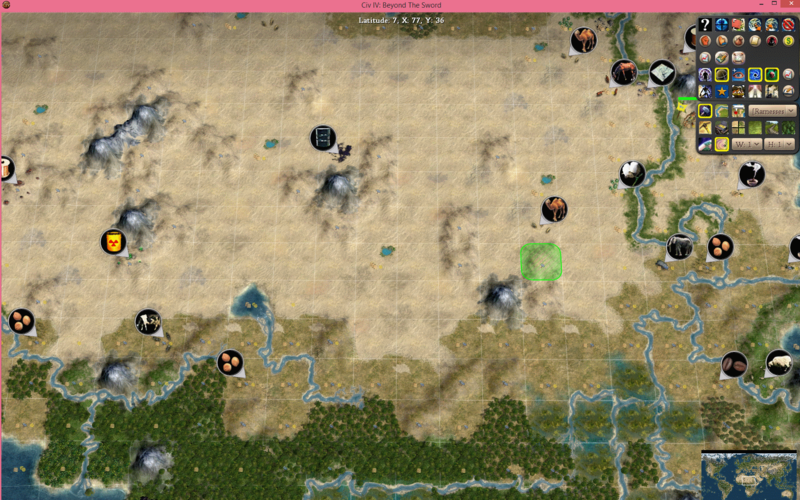
I decided to give the central Sahara region around lake Chad a bit of love. Historically decently powerful kingdoms arose in this area and right now the map makes that almost impossible.
Original:
New:
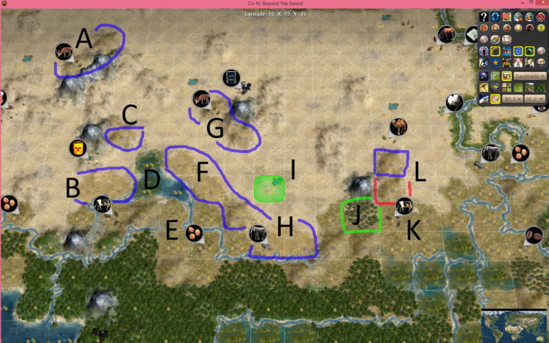
Blue denotes areas that are changed to Semi-Desert.
Red Denotes areas changed to Plains.
Green denotes an added Forest.
A: The Ahaggar Mountains are filled with local game and Fauna that the local Berbers used to survive and thrive in the mountains. Deer and an extra Hammer seems pretty reasonable to allow for a moderately sized city for the Taureg.
B: Added the Yobe River to connect to the west side of Lake Chad. Also added two Semi Desert tiles to the north to represent the Arable land along that river.
C: The Air Mountains are a decent place to raise livestock and the semi desert looks nicer than a normal desert.
D: Expanded lake Chad. The lake was once the 4th largest in Africa and with these changes it now is. I also wanted to give it the iconic shape of the lake. I expanded the lake with Lagoons covered in marshes to keep the cities off. It keeps it looking shallow and marshy like the lake looks now.
E: Shifted the Millet to allow for a decent city to be placed just north of the ivory. The Tunjur or Wadai Kingdom was roughly in this area and could become a decent city state if you wanted it.
F: Added a bunch of semi desert to lake Chad. This more accurately reflects the Sahel nature in the region. It also allows for a city to be placed along Lake Chad where the Kanem Empire’s original capital might have been.
G: The Tibesti Mountains are full of life that helped local residents carve out a living. The Deer represent the herding animals and local game. The semi deserts make the mountains look nicer and the extra hammer helps the oasis be a decent city.
H: The Ivory is here to represent rhinos. They were hunted for their horns and served as a big export for the region. It isn’t ideal, but nothing else seemed appropriate. I also expanded the Chari river to make the semi desert become the same as Plains. It also represents the various Wadis that feed into the river.
I: Shifted the Oasis down to represent lake Fitri. It could even be one square west, but it is sort of filling in for some of the mild grazing and farm land around that area.
J: The Marra Mountains are actually quite wooded, so I added the forest and hills to represent this.
K: Darfur has a huge chunk of the Sudanese livestock industry. So the Cows are added to give the region some actual resources and growth potential.
L: I added a plains tile and a semi desert above it to make the Darfur region an okay place for a city. The Darfur Kingdom sprung up around this area centered on the plains tile in the city of El-Fasher.
Original:

New:

Blue denotes areas that are changed to Semi-Desert.
Red Denotes areas changed to Plains.
Green denotes an added Forest.
A: The Ahaggar Mountains are filled with local game and Fauna that the local Berbers used to survive and thrive in the mountains. Deer and an extra Hammer seems pretty reasonable to allow for a moderately sized city for the Taureg.
B: Added the Yobe River to connect to the west side of Lake Chad. Also added two Semi Desert tiles to the north to represent the Arable land along that river.
C: The Air Mountains are a decent place to raise livestock and the semi desert looks nicer than a normal desert.
D: Expanded lake Chad. The lake was once the 4th largest in Africa and with these changes it now is. I also wanted to give it the iconic shape of the lake. I expanded the lake with Lagoons covered in marshes to keep the cities off. It keeps it looking shallow and marshy like the lake looks now.
E: Shifted the Millet to allow for a decent city to be placed just north of the ivory. The Tunjur or Wadai Kingdom was roughly in this area and could become a decent city state if you wanted it.
F: Added a bunch of semi desert to lake Chad. This more accurately reflects the Sahel nature in the region. It also allows for a city to be placed along Lake Chad where the Kanem Empire’s original capital might have been.
G: The Tibesti Mountains are full of life that helped local residents carve out a living. The Deer represent the herding animals and local game. The semi deserts make the mountains look nicer and the extra hammer helps the oasis be a decent city.
H: The Ivory is here to represent rhinos. They were hunted for their horns and served as a big export for the region. It isn’t ideal, but nothing else seemed appropriate. I also expanded the Chari river to make the semi desert become the same as Plains. It also represents the various Wadis that feed into the river.
I: Shifted the Oasis down to represent lake Fitri. It could even be one square west, but it is sort of filling in for some of the mild grazing and farm land around that area.
J: The Marra Mountains are actually quite wooded, so I added the forest and hills to represent this.
K: Darfur has a huge chunk of the Sudanese livestock industry. So the Cows are added to give the region some actual resources and growth potential.
L: I added a plains tile and a semi desert above it to make the Darfur region an okay place for a city. The Darfur Kingdom sprung up around this area centered on the plains tile in the city of El-Fasher.


")
