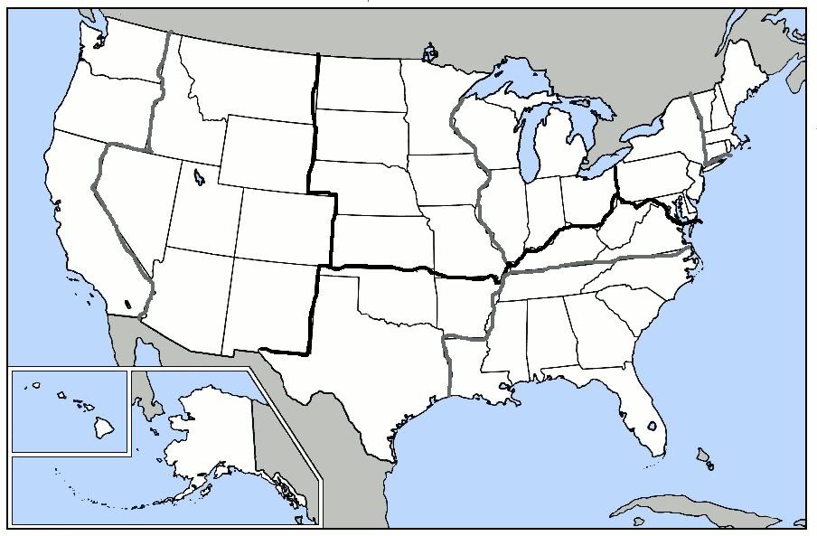
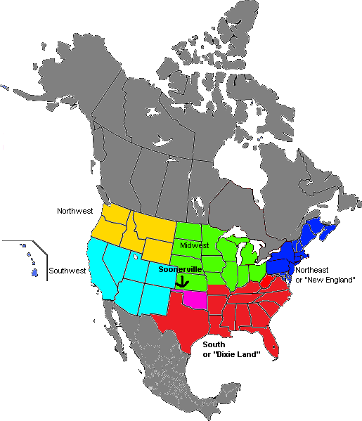
I've made two maps dividing America. The first is divided Geographically between Northeast, Midwest, South, and West. Each one of those regions has a cultural split in it. The second map is divided purely on culture.
Thick black lines are geographic boundaries and gray lines are culture:
1. Northeast
a. New England
b. Mid-Atlantic
2. Midwest
a. Great Lakes States
b. Great Plains
3. South
a. Deep South
b. Upper South (thinking back on it, NC and TN are probably better described as Upper South, but I'm too lazy to change it)
4. West
a. Mountains
b. Pacific
The thick black lines are regionally borders. The light gray lines mean there is a sub-region. The dark gray lines means there is a combination of regions.
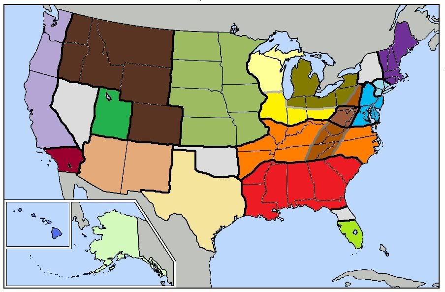
green-yellow: South Florida
red: Deep South
orange: Upper South
brown: core Appalachia
light brown: Appalachia/Upper South combo and Central Pennsylvania (I'm actually not sure what to classify Central Penn as. Pennsylvania Dutch maybe?)
light blue: Mid-Atlantic
sky blue: New Yawk
purple: New England
yellow: Great Lakes States
dark goldish color: Rust Belt
light yellow: area has many similarities to Great Plains, but still think it belongs in the Great Lakes States.
light jungle green: Great Plains
peachish color: Texas Stands Alone

sandish color: Mojave/Southwest
dark brown: Mountains
green: Utah
lavender: Pacific Coast
that reddish purplish color: Southern California
Alaska and Hawaii need no explanation
light gray: these I wasn't sure what to label
Nevada: I'm not really sure what to label it
Oklahoma: South and Great Plains combo
Central Florida: I wasn't sure where to put the Deep South/South Florida line
Upstate New York: Not sure what to label it. Upstate New York would probably be the best label.
additional note: some cities are quite different than the rest of the region they are in, but I didn't see it necessary to give them their own regions. Chicago, Minneapolis/St. Paul, and Denver are probably the best examples.

 (atlantic/russia)