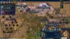
@Gedemon A comment on the mod page on Steam today reminded me that we still have problems with the continent boundaries on Play Europe Again—they're still leftover from the Civ V ones and consequently many of the mountain ranges and the tiles around them are different continents to the ones they should be in. I am also thinking though that only having the three actual continents on the map (Europe, Africa, Asia) is a bit silly for a map which is mostly Europe, and that it might be better to break the continents up into smaller regions. I've had a bit of a play around with this idea in the worldbuilder and have come up with some possible boundaries. I've included a save and the Play Your Own Custom Maps mod with the altered map file in the attached zip. The continent names don't match up, of course, but Euramerica is Iceland, Atlantica is Ireland, Avalonia is Great Britain, Lemuria is Western Europe, Cimmeria is Southern Europe, Kernorland is Central Europe, Vaalbala is Scandinavia, Europe is Eastern Europe, Asia is the Middle East, and Africa is Africa. Thoughts?