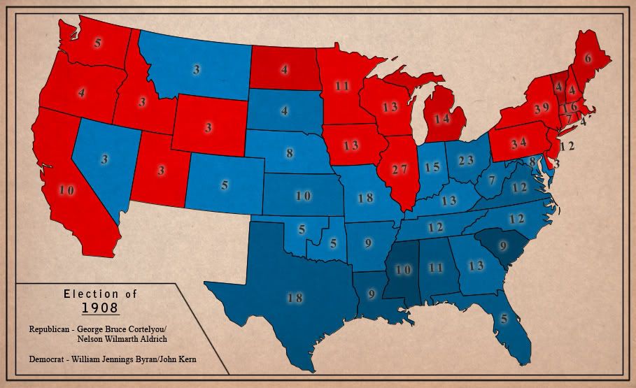
Winner
Diverse in Unity
Hm, until I find something acceptable, hammer and sickle stay.
Here's the map, 2nd revision:

Changes:
1) Austria is in NATO now. I admit that without the Soviet occupation of the eatern part of the country and the following neutralization of the country decided by both blocks, Austria would most likely join any Western European defensive pact.
2) Northern Iran was never abandoned by the USSR, and instead the occupied parts of it became new Soviet republics of Kurdistan and southern Azerbaijan.
3) Czech Rep. renamed to Czech Federal Republic (Česká Spolková Republika - ČSR [It's a dig against the commie Slovakia since the abbreviation is the same as the abbreviation of former Czechoslovakia]; Bundesrepublik Böhmen in German). This is meant to explain the post-war development in the Czech lands. Instead of getting rid of the Germans, the leadership was forced by circumstances to seek such a constitutional solution that would prevent a repetition of the Sudetenland crisis. In the end, a federal model was adopted and Bohemia/Moravia were divided into 9 federal states (spolkové země, bundesländer) + the capital Prague district. Three states are predominantly German, three are predominantly Czech and three are mixed. Both languages are official and large effort was made by the authorities to make the population largely bilingual, with partial success (mostly in the mixed states and bigger cities). 27 years after the V-E day, relations between the two nations are mostly without problems, though critics say that instead of living together, Czechs and Germans live alongside each other and mostly mind their own business. Still shamed by their war-era collaboration with the Nazis, talking about a possible secession is a taboo among the Germans in C.F.R. The country is sometimes called "the Belgium of Central Europe" by foreign observers.
EDIT: I think I'll start a thread in the history forum, I don't want to spam this thread.
Here's the map, 2nd revision:
Changes:
1) Austria is in NATO now. I admit that without the Soviet occupation of the eatern part of the country and the following neutralization of the country decided by both blocks, Austria would most likely join any Western European defensive pact.
2) Northern Iran was never abandoned by the USSR, and instead the occupied parts of it became new Soviet republics of Kurdistan and southern Azerbaijan.
3) Czech Rep. renamed to Czech Federal Republic (Česká Spolková Republika - ČSR [It's a dig against the commie Slovakia since the abbreviation is the same as the abbreviation of former Czechoslovakia]; Bundesrepublik Böhmen in German). This is meant to explain the post-war development in the Czech lands. Instead of getting rid of the Germans, the leadership was forced by circumstances to seek such a constitutional solution that would prevent a repetition of the Sudetenland crisis. In the end, a federal model was adopted and Bohemia/Moravia were divided into 9 federal states (spolkové země, bundesländer) + the capital Prague district. Three states are predominantly German, three are predominantly Czech and three are mixed. Both languages are official and large effort was made by the authorities to make the population largely bilingual, with partial success (mostly in the mixed states and bigger cities). 27 years after the V-E day, relations between the two nations are mostly without problems, though critics say that instead of living together, Czechs and Germans live alongside each other and mostly mind their own business. Still shamed by their war-era collaboration with the Nazis, talking about a possible secession is a taboo among the Germans in C.F.R. The country is sometimes called "the Belgium of Central Europe" by foreign observers.
EDIT: I think I'll start a thread in the history forum, I don't want to spam this thread.
 ), thanks.
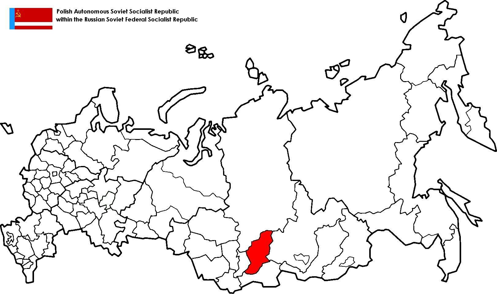


")