You are using an out of date browser. It may not display this or other websites correctly.
You should upgrade or use an alternative browser.
You should upgrade or use an alternative browser.
Guess the Map VII: Bhutan vs. Peru
- Thread starter W|M
- Start date
- Status
- Not open for further replies.
"Number of countries they border" is the only thing I can think of that would fit and I don't think that fits the data.
JohannaK
Heroically Clueless
But Metropolitan France is only 1 country.
EDIT: And of course it can't be countries bordered. Good one, but then all countries would be coloured, and nearly none would be yellow.
EDIT: And of course it can't be countries bordered. Good one, but then all countries would be coloured, and nearly none would be yellow.
Well, it could include various other French islands, but they just aren't big enough to show up on the map.
My first thought was that it had something to do with islands, but with Mali, Mongolia and a bunch of other landlocked countries coloured that can't be right.
My first thought was that it had something to do with islands, but with Mali, Mongolia and a bunch of other landlocked countries coloured that can't be right.

warpus
Sommerswerd asked me to change this
The number of countries who have something named after one of their explorers in the coloured in country? Provinces? Rivers? Mountains?
This is not just a silly comment... If you know what Chad and the Cook Islands share, you'll get what the map is about.It's rumoured Chad is eyeing the Cook Islands.
Bingo!Antipodes with X countries?
The islands out in the middle of nowhere in the Pacific align with Europe and Africa explaining the island effect.
Hope this clarifies.
")
Spoiler :
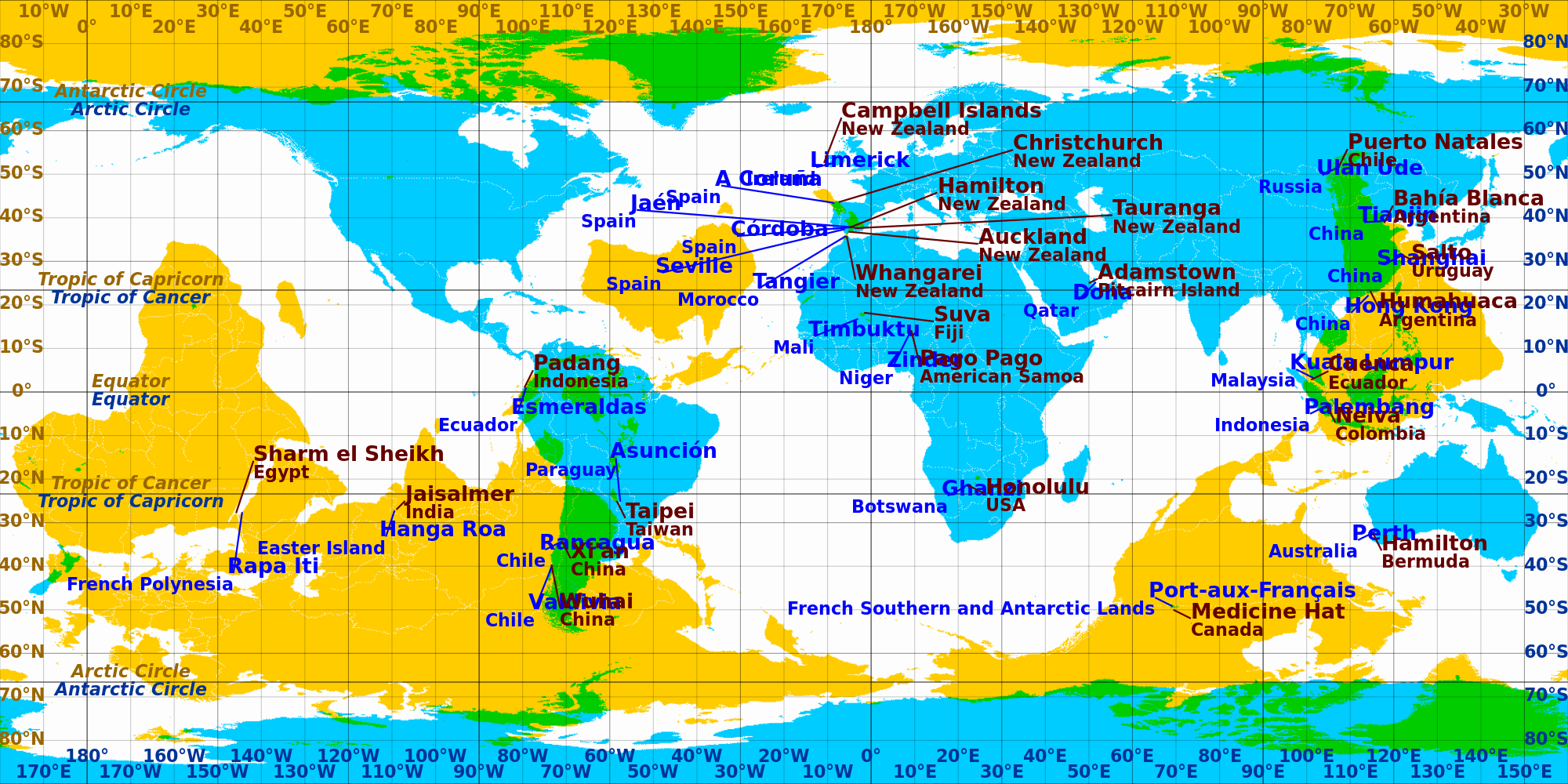
The list of countries can be found in the wiki article on Antipodes.
Peck of Arabia
Sociable Recluse
I'm going to be honest, I wouldn't have got that one if you'd have given me all the time in the world
In fact, I'm not sure I could get it now that I know the answer...
In fact, I'm not sure I could get it now that I know the answer...
JohannaK
Heroically Clueless
Me neither...
TheMulattoMaker
Dictator of RF
<Keanu>
...whoa...
</Keanu>
Good one, nocho.
...whoa...
</Keanu>
Good one, nocho.
- Status
- Not open for further replies.
Similar threads
- Replies
- 19
- Views
- 2K