- Home
- Forums
- CIVILIZATION IV
- Civ4 - Creation & Customization
- Civ4 - Project & Mod Development
- Civ4 - Rhye's and Fall of Civilization
- Rhye's and Fall - Dawn of Civilization
You are using an out of date browser. It may not display this or other websites correctly.
You should upgrade or use an alternative browser.
You should upgrade or use an alternative browser.
Master Map Thread
- Thread starter Royal Tenenbaum
- Start date
Pavel Chichikov
King
- Joined
- May 26, 2012
- Messages
- 674
That's rather ridiculous. England and Egypt used cavalry and raised horses just as much as Poland and Russia. Taking these away would also reduce their productivity, which both nations need. Horses weren't shipped, and if Poland was to war one of these nations they'd be screwed.
You're exaggerating how much oil comes from the Middle East. And Manchuria was a very strategic location, hence why Japan invaded it.
That would make Australia insanely useful for a region that doesn't even have a civilization for. And Sweden has it tough the way it is. Perhaps you haven't looked at the Master Map edits well enough to see that it has reached a good balance.
Yeah... you haven't even looked at the Master Edits. We already did that, except it was iron on Oman instead of stone.
I agree.
Sounds good to me.
- England has always had quite limited cavalry compared to France, Poland, Spain ect. England has always been known for it's highly trained Infantry and Archers. The horses would be replaced with sheep. And there's no reason England can't get horses from Spain/Poland/Russia/the Americas/Byzantines ect. And only the very richest nobility, many whom fought in foot, could afford horses in England, check the history books. Also having horses in England makes it to easy for a human player.
- Egypt didn't have any horses until the Hyskos introduced them. Later they imported them from Arabia and the Maghreb.
- It's more for gameplay reasons than anything. And otherwise there's no reason for Korea not to settle Manchuria everyime. Manchuria also not a major oil source.
- Turn the grass into plains, remove the seafood resources and expand the jungles. There are dozens of hills on the map much higher than Australias 'mountains'. Half of the worlds Uranium is located in Australia, mining contributes something like 25% of the GDP in real-terms.
- To be honest no, I haven't yet. I should take a look.
asewland
Warlord
I tried map designing for the first time today. It didn't end well...
BTW I can't seem to open up the map you posted, RT. It keeps saying 'fail to uncompress'
BTW I can't seem to open up the map you posted, RT. It keeps saying 'fail to uncompress'
Royal Tenenbaum
Write your Own History
- Joined
- Oct 23, 2012
- Messages
- 2,749
I tried map designing for the first time today. It didn't end well...
BTW I can't seem to open up the map you posted, RT. It keeps saying 'fail to uncompress'
Could be due to the dated SVN.
Royal Tenenbaum
Write your Own History
- Joined
- Oct 23, 2012
- Messages
- 2,749
Because they make a lot of sugar, and it surely made Odessa worth settling.
Ok, thanksBecause they make a lot of sugar, and it surely made Odessa worth settling.
")
I've just updated the maps to SVN 752 changes, like southern Russia, Armenia, Iran etc. It seems it works.
I've eliminated indie Riga from these maps because Leoreth added Polish Wilno.
I'd like to make some new resources properly popped/erased afterwards. I'd love to read some opinions about, maybe I'll show a list of resources with their supposed correct timing.
I've eliminated indie Riga from these maps because Leoreth added Polish Wilno.
I'd like to make some new resources properly popped/erased afterwards. I'd love to read some opinions about, maybe I'll show a list of resources with their supposed correct timing.
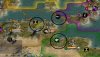
Attachments
I also want to propose a change in North Africa. AI usually found Qusantinah (on marble) and Wahran (1E of Al-Jaizir) instead of most important Tunis and Al-Jaizir. I'd switch wheat with marble and, to make Tunis or, why not, Sicily good places to settle, add a spawning fish 1W of Palermo. I'd set this spawning resource around 900 AD because from that time Tunis and Palermo became to be important under Arabian domination; Tunis was the second city of the Fatimid Caliphate and Palermo, capitol of Emirate of Sicily, "begun to compete with Córdoba and Cairo in terms of importance and splendor" (from Wikipedia). Another reason is that in this spot there was, for centuries, an intensive fishing of tune (I'm serious!).
Here's a test with the new proposed setting.
Here's a test with the new proposed setting.
Attachments
I'd say historically Oran is roughly as important as Algiers.
I'd say historically Oran is roughly as important as Algiers.
You're right, but not Qusantinah, the target of my intention.
Royal Tenenbaum
Write your Own History
- Joined
- Oct 23, 2012
- Messages
- 2,749
I have began making a little more minor changes. For instance, the possible ocean canal city on Guatamala City is now avoided, as I turned the mountain 1NW of it into a hill, moved the silver on that hill, moved Guatamala City 1N, and made the original location for Guatamala City a mountain.
Publicola
King
- Joined
- Apr 26, 2014
- Messages
- 763
I'm not an expert by any means, but I remember reading a discussion about how the map of China, and especially Manchuria, was flawed in terms of how little it resembles China on a real-world map. I haven't noticed much wrong with it (but as above, I'm no expert), so I wanted to ask: 1) are there noticeable differences between the DoC and the real-world map? 2) If so,is the critique valid, or were the differences meant to improve gameplay? and 3) If valid, do the changes in this thread address it or is that still up in the air?
Sorry I can't be more specific about what's wrong, but I'm going by fairly foggy memories at this point.
Sorry I can't be more specific about what's wrong, but I'm going by fairly foggy memories at this point.
The RFC map is based on the Robinson projection. Any projection of a sphere to a rectangle distorts some areas, especially areas closer to the poles. Comparing China to Kamchatka is therefore not fair.
Europe, especially Britain, and Japan have been enlarged. Again, that might make China look small by comparison.
Relative to the rest of the map I don't think China is undersized.
Europe, especially Britain, and Japan have been enlarged. Again, that might make China look small by comparison.
Relative to the rest of the map I don't think China is undersized.
Jarlaxe Baenre
Emperor
This seems like the best place to mention it: The city name map for western Canada seems a bit off. I just glanced at some cities England founded over there, and it seemed a bit weird that Edmonton was hugging the mountains; that would place Calgary right on top of a mountain.
Now they've founded Calgary in my game, and... it's in the middle of the Rocky Mountains. If I stand on a hill or something else allowing me to see something other than just houses, I can see the rockies from here if I look west, but they're still about an hour's drive away.
The names match up if you line the places up with other places on the map (Calgary is north of the gulf of California in both real life and the game map, and west of the southernmost point of Hudson's bay), but Calgary is definitely not in the middle of the rockieswhere England founded it in my game is pretty much Spokane (on the silver).
Western Canada's always looked a bit weird on Rhye's Earth map, and now I realize whythe last few hundred kilometres of prairie were squished into mountain.
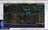
Attachments
merijn_v1
Black Belt
Canada got a major overhaul in the SVN. That map is kinda obselete now.
Royal Tenenbaum
Write your Own History
- Joined
- Oct 23, 2012
- Messages
- 2,749
Preparing for the release of Part II of Ironclad Oath, I have been reviewing my Master Map, and have made several changes to incorporate the new changes to south Russia and Canada.
I have also reworked west Africa, and it can now include several of the small Ivory Coast nations and now Senegal is worth settling. I have also removed fish resources from several small islands as they shouldn't have large populations.
Detroit is very interesting for me. It is in America's interest to settle Detroit to try and steal Toronto's pig and increase US population stability. However, it is very easy for Toronto to steal the tile back through culture (which I attribute in real life to Detroit's degradation of culture, and thus the collapse of the city).
Royal Tenenbaum
Write your Own History
- Joined
- Oct 23, 2012
- Messages
- 2,749
I'm working on what I call the Grandmaster Map. This is going to be a lot more comprehensive than the Master one.
For instance, I slightly tweaked Central America to represent all the countries there.
Now you can conquer Granada and fight for Honduras!
I also completely redid the Pacific.
Although Leoreth's remake of it was good, I don't think it was accurate.
For instance, I slightly tweaked Central America to represent all the countries there.
Now you can conquer Granada and fight for Honduras!
I also completely redid the Pacific.
Although Leoreth's remake of it was good, I don't think it was accurate.
LacsiraxAriscal
Below Settler
The 1 NE of Chang'an as China (ie, where I put my capital) doesn't appear to have a dynamic name. Very strange.
Similar threads
- Replies
- 103
- Views
- 11K
- Sticky
- Replies
- 9
- Views
- 9K
- Replies
- 49
- Views
- 6K