silver 2039
Deity
- Joined
- Jul 26, 2003
- Messages
- 16,208
The boundary between China and India has never been formally delimited. But the two peoples had been living together in peace and harmony, and no dispute had even arisen before the arrival of the British colonialists. This was because a traditional customary boundary line had long taken shape on the basis of the extent of each side's administrative jurisdiction in the long course of peaceful existence. This line was respected by both the Indians and the Chinese.
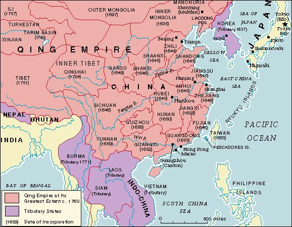
The eastern sector of this traditional customary boundary runs along the southern foot of the Himalayas, the middle sector along the Himalayas, and the western sector along the Karakoram range. This traditional boundary was not only respected by China and India over a long period of time, but also reflected in early official British maps.
Before 1685, the delineation of the western sector of the Sino-Indian boundary in official British maps coincided roughly with the traditional line, and before 1936 so did the eastern sector. But from the second half of the 19th century to the beginning of the 20th, British imperialism was actively engaged in conspiratorial activities of aggression against China's Tibet and Sinkiang provinces.
Various attempts were made to obliterate the traditional boundary line, carve up China's territory, and expand the territory of British India. At the Simla Conference in 1914, the British representative drew the notorious "McMahon Line" through a secret exchange of letters with the representative of the Tibetan local authorities, attempting thereby to annex 90,000 square kilometres of Chinese territory.
In the western sector, British imperialism laid covetous eyes on Aksai Chin in the 1860s by sending military intelligence agents to infiltrate into the area for unlawful surveys and working out an assortment of boundary lines.
The British attempt to impose the McMahon Line on the Chinese and alter to its own wishes the traditional border in the western sector was promptly rebuffed by the then government of China and successive Chinese governments. Therefore, from 1865 to 1953 British and Indian maps either did not show any alignment of the boundary in the western sector, or showed it in an indistinct fashion and marked it as undefined. And it was only from 1936 onwards that the illegal McMahon Line in the eastern sector appeared on British and Indian maps, but up to 1953 it too was designated as undemarcated.
was not until the last phase of World War II that British imperialism started to intrude into and seize a small part of the area lying south of the illegal McMahon Line and north of the Sino-Indian traditional border.
In 1947 and 1949, respectively, India and China attained independence. Thanks to their mutual efforts, they established diplomatic relations quite early, jointly initiated the famous Five Principles of Peaceful Co-existence, and signed the Agreement on Trade and Intercourse Between the Tibet Region of China and India. This helped bolster friendly relations between the two countries.
The Chinese government has held that in dealing with the boundary question, neither China nor India should shoulder the blame for the legacy created by imperialists. Since both had won their independence, each side should overcome the interference of history and seek a settlement of all unresolved issues, including the boundary question, in a spirit of mutual understanding and accommodation.
But after the founding of New China and particularly after the peaceful liberation of Tibet, the Indian government pressed forward in an all-out advance on the illegal McMahon Line in the eastern sector and completely occupied Chinese territory, including Tawang, south of that line and north of the traditional boundary.
The Chinese government did not accept the Indian encroachment, but took the position that an amicable settlement should be sought through negotiations, and that, pending a settlement, the status quo of the boundary should be maintained. China still does not recognise the so-called McMahon Line, yet in the interest of settling the Sino-Indian boundary question through negotiations, it has refrained from crossing it.
tranquillity prevailed along the Sino-Indian border because China adhered to the policy of seeking an amicable settlement of the boundary question, But the Indian government not only aided and abetted it and connived at their anti-Chinese political activities in India, but also formally presented to the Chinese government a claim to large tracts of Chinese territory.
It not only asked Beijing to recognise as legal Indian occupation of Chinese territory in the eastern sector, but also to recognise as part of India the Aksai Chin area in the western sector, which India had never occupied.
The gravity of the situation lay not only in India's extensive claims to Chinese territory, but also in its subsequent use of force to unilaterally change the state of the boundary.
Therfore we were forced to take action.

") .
.