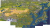
Hey I just discovered this project and am really excited for it! I normally play East Asian Civs and as I was reading through all the posts the one picture of Japan and Korea seemed a little awkward? I can't see the files (or don't know how to) so I just wanted to ask if there is decent priority for the really important cities in Japan. Like Osaka, Kyoto, Sendai, Fukuoka. or if you just gave every tile a city and Osaka, Kyoto, etc happened to not make the cut in your screenshot. I can understand if you gave each tile a different city as its so condensed, it was just a little odd to see none of those major cities. Also Incheon is incredibly close to Seoul and I would imagine Seoul would take greater preference in most cases, just want to make sure that isn't skimped (As Korea seems pretty small). There was very few cities on Korea so I don't know the extent of coverage there.
Also a small little request, as it seems people are incredibly passionate about mapping out all possibilities with the Civ Specific names (A good thing! As I saw Rome had a name for a hefty amount of Europe) that Japan also get some colonial treatment. As in WW2 it covered a large part of the Far East and I am fairly certain the enjoyed renaming cities as well. So being able to cover East Asia in Japanese sounding names in a WW2 or WW1 esque scenario could be pretty fulfilling. (You could probably attach Chinese names to Korea as well for its times of occupations for a China specific naming, but I am less sure of the history there)
Thank you all for your hard work! It looks awesome to see all this development!
")