You are using an out of date browser. It may not display this or other websites correctly.
You should upgrade or use an alternative browser.
You should upgrade or use an alternative browser.
Altered Maps VII: Making the World a Better Place
- Thread starter Joecoolyo
- Start date
- Status
- Not open for further replies.
Your Deutsche Orden southern border isn't right, and is ass-ugly to boot. Terra Mariana is semi-right, albeit simplified, and also looks gross, and the name is misleading since it seems as though you're labeling Deutsche Orden territory as "Bishoprics" in addition to the actual, y'know, bishoprics. Brandenburg's northern border looks off by a lot. Saxony's borders are far too clean, as are "Austria's". Austria is also incorrectly named; not all of that territory belonged to a(n) "[Arch]duchy" (see: Steiermark, Tirol, Kärnten). It would be better labeled, perhaps, as "Habsburg hereditary possessions".Did a bit more research, updated a couple of places, Mesoamerica, East Africa, one new Indian State that I missed out before.
Spoiler :

Also, since you're going to the trouble of indicating the HRE's "borders", why not do the same for the Kingdom of France? It's in basically the same situation.
Shekwan
Kim Chi Quaffing Celt
A Southerner's Eye-View of the British Isles...Spoiler :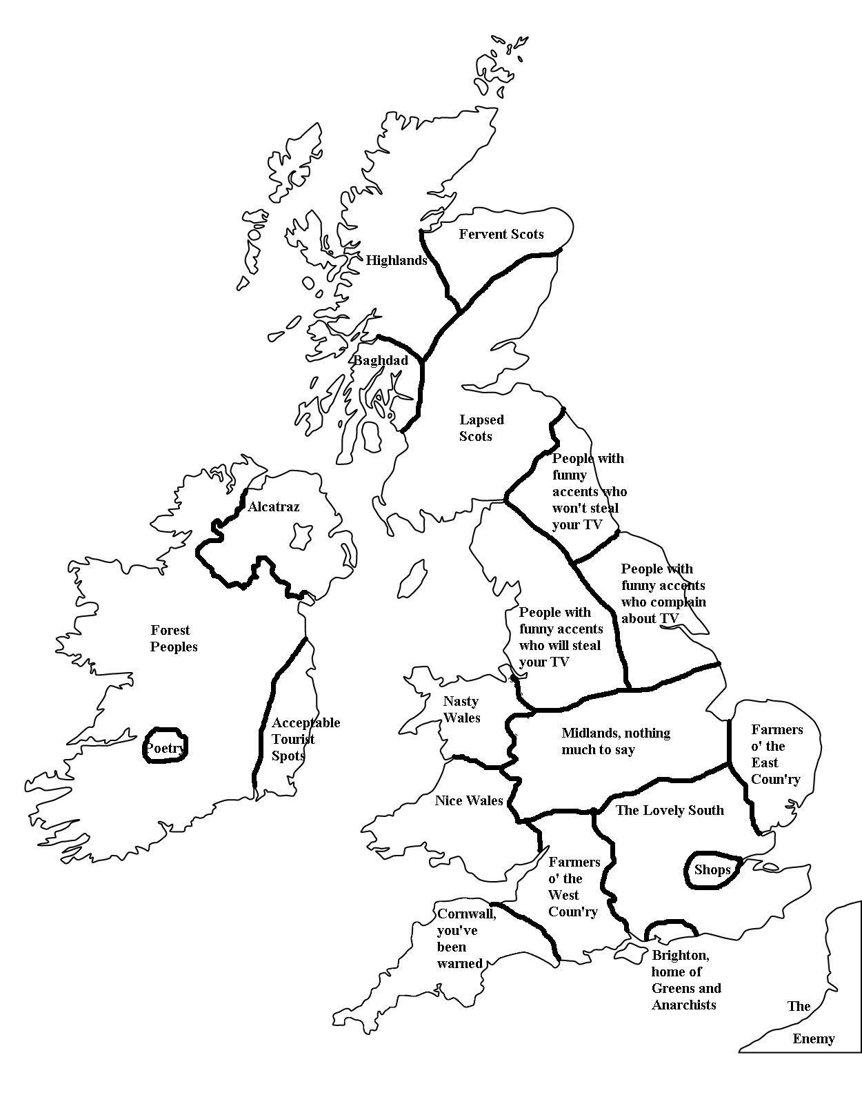
I find that map very offensive.
I'm a bog person!
I would never associate with those forest scum.
Also, since you're going to the trouble of indicating the HRE's "borders", why not do the same for the Kingdom of France? It's in basically the same situation.
Cause, with the Hundred Years War already complicating the borders, this would make it worse, and he doesn't care enough to do that. Besides, even with the war going on, it was still considerably more unified in the 1420's than the HRE ever was.


madviking
north american scum
Spoiler ginormous :

classical_hero
In whom I trust
I love how America claimed Canada.
Lord of Elves
Suede-Denim Secret Police
- Joined
- Oct 31, 2009
- Messages
- 6,976
The most WTH aspect of that map is how the British Empire, even as a Great Power and a victor in the war, loses everything except for a number of overseas naval bases and Australasia.
The Second World War did a massive number to Britain's economy, putting it in massive debt, as well as the rationing that occurred afterward, and the general dereliction of quality of life, forcing the de-colonialization of what had previously been part of the largest imperial nation-commonwealth in human history.
Not even mentioning the hand FDR had in taking apart the Empire at the seams and sticking the British with the bill.
Canada was a Dominion anyway. So was South Africa. India could've been made one.
Countries like Egypt were ruled by de facto British puppets and British colonies in Africa were either protectorates or ruled only by a few thousand officers, so the cost of administration isn't that great. These territories could be granted more self-rule but remains part of the British Commonwealth.
Whoever made that map treated Britain like it's not even an Allied country. It even lost Ulster.
sophie
Break My Heart
I love how America claimed Canada.
...and Mexico, and Central America.
The most WTH aspect of that map is how the British Empire, even as a Great Power and a victor in the war, loses everything except for a number of overseas naval bases and Australasia.
Eh, "Great Power" doesn't/didn't really mean much in the age of the Superpower
Things I noticed:
Austria being part of Germany
Part of the Rhineland being given to France
Hainan and Taiwan being in the U.S. sphere
Also, United Africa? All you can say is "lol"

NedimNapoleon
Weird Little Human
 WARNING VERY LARGE IMAGE
- Status
- Not open for further replies.
Similar threads
- Replies
- 559
- Views
- 29K
- Replies
- 0
- Views
- 3K
- Replies
- 211
- Views
- 37K
- Replies
- 1K
- Views
- 98K