Your proposition goes directly against my intent with marshes, which is clearly implied in the post you are quoting.
- Home
- Forums
- CIVILIZATION IV
- Civ4 - Creation & Customization
- Civ4 - Project & Mod Development
- Civ4 - Rhye's and Fall of Civilization
- Rhye's and Fall - Dawn of Civilization
You are using an out of date browser. It may not display this or other websites correctly.
You should upgrade or use an alternative browser.
You should upgrade or use an alternative browser.
[Development] Alternative Map during 1.17
- Thread starter Leoreth
- Start date
Please refer to what I said above. Aesthetic concerns are best addressed by aesthetic varieties.
New update:
- adjusted terrain in Scandinavia
- adjusted globe view texture to recent terrain changes
- restored new corporation icons
- added additional regions and updated them to the new map
- adjusted terrain in Scandinavia
- adjusted globe view texture to recent terrain changes
- restored new corporation icons
- added additional regions and updated them to the new map
Some context on recent development: I have decided to keep the map as it is now (there are currently no open suggestions I haven't implemented yet). You can keep making suggestions and I will implement them if possible, but at this point coastlines are set in stone except minor changes. That is why I have started working on the underlying maps, e.g. now with the region map. Next, and also last, on the agenda is the city name manager.
As discussed before, I will transition it to one global base map that is used by all languages. Improved mechanisms for different cities sharing the same tile and name changes for cities will also be added. I will also provide mechanisms to make viewing and editing the city name map easier. Lastly, I want to provide unicode support (or rather, full Windows-1252 support with Python unicode) so you can write out special characters as u"Königsberg" etc. instead of escaping the umlaut, as is already possible for great people names.
This will allow us to kickstart the suggestion phase for the city name map, which I expect will take some time, in which I can let my involvement with the map rest and turn to bug fixes and other changes.
merijn_v1
Black Belt
Can you show it as part of an existing jungle? Like, replace the existing marsh variety with the new one in Congo?
On a first look, it may help to colour grade the trees a little to make them more drab or blue tinted. Also, how does it look with a bit more underbrush?
On a first look, it may help to colour grade the trees a little to make them more drab or blue tinted. Also, how does it look with a bit more underbrush?
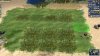
Wow, what a thus far missed opportunity.There are already 3 varieties of the marsh feature in the mod. But only 1 is used.
We could allow clearing of the Amazon and Congo marshlands but then it would have to trigger rapid regional (and possibly global) climatic changes.
merijn_v1
Black Belt
Can you show it as part of an existing jungle? Like, replace the existing marsh variety with the new one in Congo?
On a first look, it may help to colour grade the trees a little to make them more drab or blue tinted. Also, how does it look with a bit more underbrush?
Here it is.
I didn't change anything to the model in this image. The blue color is the result of the marsh terrain type.
Spoiler :
EDIT:
Some variations with some underbrush. I made 3 versions: only grassy underbrush, light underbrush and dense underbrush.
Spoiler grassy :
Spoiler light :
Spoiler dense :
Bonus: A WIP version with the shadow of the jungle. But that looks a bit too dark, so in the versions above I used the savannah shadows, which only uses the shadow of the trees, not the underbrush.
Spoiler too much shadow :
Attachments
Last edited:
It's probably also better to see this on top of Blue Marble instead.
merijn_v1
Black Belt
Thanks!
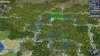
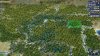
I checked out the map branch and only the 3000BC scenario is playable with the new map.
Loaded that up as England and it blocks with 26 turns to wait. Tried it multiple times. If I hit space/enter I get a catapult at (0,0), where the Turks have a lot of units (settlers + crossbowmen + scout)
Same behavior for France, Russia, etc.
Is there anything I'm missing with the alternative map version or is the branch not playable?
Either way, thanks for the work you're putting into the mod
merijn_v1
Black Belt
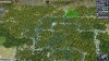
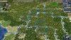
You're not missing anything. The branch is not playable yet. And finishing it to a point so it is playable isn't even in the planning for the 1.17 release.
This branch is not meant to be played. It is shared only to allow collaboration when developing the map.
This branch is not meant to be playable. There is no reason to start any other civ than Egypt really.
New update:
- moved region map to CSV file
- added city name map as CSV file (not actually being used yet)
I will give a more detailed explanation later, but the idea is to store everything that is a "map" (regions, city names, settler values ...) in CSV files instead. CSV is short for comma separated values, i.e. not much different from how they looked in Python (each row is a row in the map, separated by commas). The advantage here is a) less overhead when editing because there are no parentheses or quotation marks, b) CSV files are supported by spreadsheet editors like Excel or Calc so they are much easier to edit (you should be able to open and edit them directly) and c) they support unicode (i.e. special characters) without problems.
I have also added a utility module named MapUtils that is meant to make interacting with those maps from inside the game easier. In particular, this is meant to help when editing city names in game. Here I have exposed two functions: loadCityNames will load the entire city name map and display the names in game as signs, saveCityNames will save all signs as city names for their tiles in the city names file. I need to make some additional preparations for working with city names and will post a more comprehensive explanation of how this can be used at that point.
Temujin8k
Fluyts, Grand Vizier of Your Mind
I've actually been maintaining my own version of the City Name Map ever since work on the bigger map started. Everyone is welcome to make contributions and revisions. The map is around 60% populated with city names (based on # of non-Peak land tiles), although many areas of the map are not yet done, mostly because I don't know how to fill those regions up. There's a tCityMap worksheet which puts the quotation marks on each value, and this is the worksheet I export to CSV.
Main issues:
Main issues:
- I still have to clean up the CSV before exporting it, because it adds a lot of quotation marks (maybe due to the implementation of the Excel formulas). Cleaning up can be done in just 3 find-and-replace steps, though.
- Special characters (e.g. accented characters) here are escaped via HTML ( &#XXX; ), since Leo just mentioned about implementing Unicode strings instead recently. I'll convert these to Unicode within the day. (EDIT: Fixed as of 2:30 PM UT+8)
- Some parts of the map not yet updated: Horn of Africa
Last edited:
JHLee
Prince
- Joined
- Aug 27, 2013
- Messages
- 581
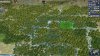
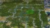
Speaking of catapults, catapults spawn in the southwestern corner of the flipzone in the main branch as well. Ive seen that happen for England multiple times, and once for Brazil and Argentina as well.
I mean, the catapult spawn happens in the current map as well.This branch is not meant to be playable. There is no reason to start any other civ than Egypt really.
Similar threads
- Replies
- 27
- Views
- 6K
- Replies
- 735
- Views
- 145K
- Replies
- 92
- Views
- 7K
- Replies
- 34
- Views
- 11K