[Development] Map Suggestions

We have not established that, the observation has been made that Egypt is wide but that it is too wide is interpretation. As I suggested above, Egypt is deliberately wide both in this map and the current map because the Nile is an actually important area of the map that many civs interact with (Egypt, Greece, Rome, Byzantium, Arabia, Turkey) so adequate space needs to be given to it to reflect that. The Nile is both more relevant than the Sahara at whose expense it was expanded and than Senegal/Cameroon or whatever place's expansion would be justified by its size.
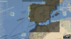
Okay, but there is also large swathes of unimportant desert in Egypt and Sudan... And you'll notice that I opted not to compress that area anyway as it was more a problem of where the political boundaries were placed.

I will contend that these areas are very historically important. Western Africa were some of the first colonial outposts of European empires as they sought slaves to build their colonial empires in the New World and beyond. The Portuguese colonised West Africa before Angola. Not to mention the numerous vibrant indigenous civilisations that were there for a time unfortunately underrepresented by one civ, Mandinka, and hordes of aimless Native Pombos. It is no chance that Europeans did not (heavily) colonise Africa first. African civilisations were able to hold their territory and opted instead to engage in slave trade while the European civs were kept to the coast (but they were there none the less).

As far as giving space for different civs interacting with the region
How many civs interact with Egypt at any given time?
Ancient: Egypt, Assyria
Classical: Persia, Greece, Rome
Middle Ages: Byzantium, Arabia
Medieval Ages: Mamluks, Ottomons
Colonial: Ottomons
Industrial: Ottomons, France (kinda), England

How many civs interact with West Africa at once?
Early Colonial: Spain, Portugal + African civs
Mid Colonial: Spain, Portugal, England, France + African civs
Late Colonial: Portugal, Netherlands, England, France, Spain + African civs
Industrial: Portugal, Netherlands, England, France, Spain, America, Germany
 
This is my last suggestion for Africa (...for now)

It took me a while to get around to but the shape of Ethiopia just didn't quite match reality and Ethiopia is definitely an important area of the map. Sudan seemed outsized, Ethiopia seemed tiny and misshapen and I think the problem lay in the Horn itself. If you look at the Robinson projection the point of the Horn should be roughly 2/3rds of the way across the Yemeni Southern Coast which on the original big map means it's about two tiles West of where it should be (it barely makes 1/3rd). So I moved a 7X7 square starting at 84,33 1E. This moved the horn to its appropriate place. Even the island of Socotra (after I adjusted it accordingly) seems to be in a better position relative to the Seychelles. Then I added two tiles along the African Coast in the Red Sea giving it that pinch at Djibouti and allowing me to move Eritrea on top of Ethiopia where it belongs. Finally I added one land tile below Kenya which allowed me to move Kenya's southern point in line with the southern border of Burundi. Long story short these changes allowed for a little more space. I haven't looked at the terrain/rivers yet but now there is a bit more space to work with for Greater Ethiopia.

Only problem is Zanzibar is now attached to the land but that's probably resolvable. I'm not sure why it's not just an island feature anyway.

Spoiler :

Horn of Africa Shape.png

 
Last edited:
Oh wow, I didn't mention I stretched that overlaid image out significantly to make it fit. That was me trying to fit the map Iberia to our game's Iberia. Without editing, Portugal's coast was two tiles east, and the northern coast was one tile south.
I just did this using the Robinson projection over your image. It's not quite as severe as with whatever you used.
 

Attachments

  • robinson.png
    robinson.png
    2.8 MB · Views: 475
I just did this using the Robinson projection over your image. It's not quite as severe as with whatever you used.

I wonder what projection I did use, then. Well, I've never made any claims about knowing what I'm doing, so I'll reference Robinson projection in the future for this thread.
 
Why can't we have both Lisbon and Porto?
Seconded, especially since we're moving to a bigger map (and having a one-city core isn't ideal for a colonial power). Not to mention, if those Robinson map overlays are any indication, Lisbon should be one tile further south of where we have it, which does open up space for Porto one tile north. We'd need to shift the Tagus one south to compensate, but that shouldn't cause any problems at all.
 
Then I added two tiles along the African Coast in the Red Sea giving it that pinch at Djibouti and allowing me to move Eritrea on top of Ethiopia where it belongs.]

I think that the top tile you added shouldn't be added. Maritime trade was very important for the Kingdom of Aksum. Having Aksum between the lake and the coast, which is the correct location https://janakesho1.wordpress.com/2016/01/26/kingdom-of-aksum-axum/ (No idea why Rhye placed Aksum on the tile it currently is), does represent the maritime trade very well and I think Ethiopia having sea access is good for gameplay in general. I am aware that Aksum is not coastal IRL by itself, but I think it is coastal in terms of gameplay, similarly how London and Rome are also coastal ingame.

And if you remove that tile, I think that the other tile you added should also be removed, because I think the shape will look a bit distorted if you remove only the top tile.
 
If Iberia will be left with a coast tile in the southwestern corner, like in the current map, the only problem I see is that Spain might settle Santiago 1N of Porto. If that's the reason, then the AI could just be programmed to settle La Coruna more often.

Or they could settle Porto themselves, and have it flip to Portugal?
 
Im against the corn spawning in Spain.
One of the biggest challenges in playing Spain is managing stability while having a big colonial empire and low food core area.
Also, to encourage historocal lategame power-balances, I think the only Euro civs who have Uranium in their core should be the nations which have nukes IRL; UN security board members - UK, Fra, Rus.
 
I think that the top tile you added shouldn't be added. Maritime trade was very important for the Kingdom of Aksum. Having Aksum between the lake and the coast, which is the correct location https://janakesho1.wordpress.com/2016/01/26/kingdom-of-aksum-axum/ (No idea why Rhye placed Aksum on the tile it currently is), does represent the maritime trade very well and I think Ethiopia having sea access is good for gameplay in general. I am aware that Aksum is not coastal IRL by itself, but I think it is coastal in terms of gameplay, similarly how London and Rome are also coastal ingame.

And if you remove that tile, I think that the other tile you added should also be removed, because I think the shape will look a bit distorted if you remove only the top tile.
I dunno, I'd say Axum goes on the cow, which is still on the sea. It's closer to the sea than the lake anyway. It's also possible the lake should be moved. As I said I didn't adjust the rivers and terrain.
 
Fair point. It didn't occur to me that Aksum could also be move and placing it on the cow tile on your suggestion would also be quite accurate. Now I see it with that explanation, I like your suggestion.
 
Why can't we have both Lisbon and Porto?
In my opinion, it's because Portugal is supposed to look outwards to become powerful, having three "European" cities (Ponta Delgada is one technically) would give them more Continental troubles to keep in mind. Spain would probably get unhappy about border tension and stuff, considering they usually settle Santiago (which is right where Oporto would be, north of the Duoro river). If anything, Portugal's second city on the continent would be Coimbra, but that's not as historically important. In any case I think Portugal should be encouraged to look outward and do what they do best - ignore European affairs and go claim all that Brazilian and African clay.

Im against the corn spawning in Spain.
One of the biggest challenges in playing Spain is managing stability while having a big colonial empire and low food core area.
Also, to encourage historocal lategame power-balances, I think the only Euro civs who have Uranium in their core should be the nations which have nukes IRL; UN security board members - UK, Fra, Rus.
That's a fair point about the corn. But it still feels really weird not to have any Columbian resources in the civ that brought them to Europe in the first place.
And yes, I agree with the uranium, only UK, France, and Russia should have easy access to it in Europe. I just thought it was interesting that uranium mines are found in both Portugal and Spain.
 
I think I'm a bit out of the topic but I think I need to talk about Japanese Silver.

There was a massive amount of silver produced in the western part of Honshu Island. Iwami Silvermine (石見銀山) in Shimane-ken had one-third of the World's silver production in the early 17th century. It was an important motive of coinage and empowered modernized commerce in the Tokugawa shogunate era.
I'd propose to put it in the 2W of Kyoto in the current version of the map - if I remember correctly.
 
That's very good to know, I had wondered about the accuracy of this resource before.
 
2019-03-29 03.45.43.jpg

A) A gold resource here to represent the gold mines in Korea, which were among the most productive mines in the late 19c ~ early 20c.
https://www.jstor.org/stable/3636264?seq=1#page_scan_tab_contents
During their colonial rule over Korea, Japan became the 3rd producer of gold in the world.
B) A Spice here to represent Ginseng, the biggest export good of the Joseon Dynasty. Ginseng was sold very expensively in China and Japan.
(Since ginseng is used as medicine, I thought spice would represent it better than tea gameplay-wise. Spice gives health with the right building - pharmacy, if Im not mistaken. Tea only gives additional happiness.)
C) Pearl here, to represent the mother-of-pearl craftmanship, mainly developed in the Southwestern coast of the penninsula.
D) Move the resource from tile E to here, so that it can be used by Seoul as well as Pyungyang. Since Seoul is a metropolitan city that holds more than 20% of the entire population in the nation, I think this change would enable better representation of that ingame.
Also gameplay-wise this would help Korea to utilize their new Unique Power stronger.
E) A hill here to better represent the geography. Plus it grants a bit more hammer to Pyungyang.


One might think that it would be a bit overboard if these were all implemented, so I labled them A to E, in order of historical importance (need to be represented in the game).

#Edit: now that I think of it, Ginseng may be more important then the gold in terms of history.
 
Last edited:
That said, maybe Tea should actually be +1 health and later +1 happiness with coffeehouse? Might make sense as well.
 
SOME IDEAS about North and South Caucasus:

RUSSIA:
Generally the same suggested that FINBROS have already done in his Post about Russian Map:
* one WHEAT and one HORSES near the Don and Black Coast;
* Hige but so poor Kalmyks' Steppe (medieval hordes) betwen mountains and Volga;
+ one SHEEP on the mountain part of the Russian Dagestan (currently the biggest province in the North Caucasus)

GEORGIA:
* one VINE in the Black Coast (Batumi/Agjariya/near TURKEY) - there was a peak and I changed it to hill;
* one TEA in the Georgain Swanetiya (north part) - there was a peak and I moved it one tile north;
* one COTTON in Georgian Kahetiya (eastern part);
* one SHEEP near TBILISI (which occupy free area and give some food to TBILISI)
* one free tile in the NW part of Georgia - there is historiccally main local port - Poti;

ARMENIA:
* One extra lake (lake SEVAN) in the Eastern part of Armenian land;
* One TEA in the Western part of Armenia - in the Russian/Soviet Empire Armenia have strong reputation as tea-producer;
* But in the same time lake VAN go one tile east (nowadays its eastern border of TURKEY);

Perhaps there is sense that tea/cotton appered here only in the XX сentury - it will be stimulation of USSR' so called "Light industry" (consumerism area of economy)

AZERBAIJAN:
* One extra oil in coast of Caspian Sea - by the way oil refining appeared here really early (in 1890-s - when Nicolas II was tsar of Russian Empire);
* Olives/deers/fish which stimulate growth of BAKU (the biggest city if speak about local capitals);
 

Attachments

  • IDEAS.jpg
    IDEAS.jpg
    599.6 KB · Views: 656
SOME IDEAS about North and South Caucasus:

RUSSIA:
Generally the same suggested that FINBROS have already done in his Post about Russian Map:
* one WHEAT and one HORSES near the Don and Black Coast;
* Hige but so poor Kalmyks' Steppe (medieval hordes) betwen mountains and Volga;
+ one SHEEP on the mountain part of the Russian Dagestan (currently the biggest province in the North Caucasus)

GEORGIA:
* one VINE in the Black Coast (Batumi/Agjariya/near TURKEY) - there was a peak and I changed it to hill;
* one TEA in the Georgain Swanetiya (north part) - there was a peak and I moved it one tile north;
* one COTTON in Georgian Kahetiya (eastern part);
* one SHEEP near TBILISI (which occupy free area and give some food to TBILISI)
* one free tile in the NW part of Georgia - there is historiccally main local port - Poti;

ARMENIA:
* One extra lake (lake SEVAN) in the Eastern part of Armenian land;
* One TEA in the Western part of Armenia - in the Russian/Soviet Empire Armenia have strong reputation as tea-producer;
* But in the same time lake VAN go one tile east (nowadays its eastern border of TURKEY);

Perhaps there is sense that tea/cotton appered here only in the XX сentury - it will be stimulation of USSR' so called "Light industry" (consumerism area of economy)

AZERBAIJAN:
* One extra oil in coast of Caspian Sea - by the way oil refining appeared here really early (in 1890-s - when Nicolas II was tsar of Russian Empire);
* Olives/deers/fish which stimulate growth of BAKU (the biggest city if speak about local capitals);
What is the orange country on your map?
 
One of those unrecognised Russian puppet states I presume.
 
Back
Top Bottom