Mathalamus
Emperor of Mathalia
I numbered it Math, but did you just call me an idiot?
no i did not.
I numbered it Math, but did you just call me an idiot?


It used to take weeks to cross. These days, the old Atlantic is traversed in two times three movements! And the US is right next door! Do you want to cross it? Straightaway?
The America of 1968 has a new face. It awaits you with open arms. This year, some very interesting events will take place across the river... across the Atlantic: Mexico's Olympic Games, the HemisFair... a fabulous exhibition in San Antonio, Texas, the joyous celebrations for New Orleans' 250th anniversary, etc. etc. The United States are ready to welcome you!
We at TWA are equally ready! We offer you a range of airline holidays at prices so low they'll make your jaw drop! For example, a 15-day trip to New York, trip and hotel included for only 1.581 francs!
If you travel for business, we can also help you with information on hotels, business meetings, inter-city connections, car rentals... TWA will provide it all. And TWA is the only airline in the world to link the majority of European capitals with 39 US cities. Visit America in 1968! After all, it's just across the river. To go there, fly with the company that can do most for you: TWA. Talk to your travel agent... or directly to us.

aronnax said:Aw thanks! Second Compliment. Though I must admit that my Malwa, Eastern Ganga and Mehwa States are drawn out of some imagination and vague sources.
aronnax said:Or that no one else opposed their claim.
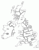
The Irish States are worse. I think coming up with an accurate map of Ireland in any given year would be worthy of some sort of publication.Oh the horror... All those German States. If you guys can see clearly, I drew in the larger electorates, most of the Italian States and some Dutch places but gave up trying to dissect the mess that is the HRE.
ParkCungHee said:The Irish States are worse. I think coming up with an accurate map of Ireland in any given year would be worthy of some sort of publication.

It helps when you have sources. Pity me
The Irish States are worse. I think coming up with an accurate map of Ireland in any given year would be worthy of some sort of publication.
I remember buying a book on general SEA history in Thailand. I failed to flip through it thoroughly before buying, and discover it almost exclusively covers the colonial period, and it didn't go into that much details either.
There are also many Swahili states which could be added to the map.
aronnax said:It is depressing that SEA history is so badly recorded.
taillesskangaru said:I remember buying a book on general SEA history in Thailand. I failed to flip through it thoroughly before buying, and discover it almost exclusively covers the colonial period, and it didn't go into that much details either.
Technically, England never held territory in Ireland. Even extending control to it's theoretical limits, what you have there is the Kingdom of Ireland, a seperate kingdom that happens to have the same Monarch.Thank God the English painted Ireland a nice sturdy red.
You would think so, but somehow it doesn't. Mainly because the sources have a limited conception of "a border"It helps when you have sources. Pity me
Technically, England never held territory in Ireland. Even extending control to it's theoretical limits, what you have there is the Kingdom of Ireland, a seperate kingdom that happens to have the same Monarch.

Well in 1412, it was a bit more then a technicality. The Kingdom of Ireland had it's own parliament, it's own armed forces, raised it's own taxes, conduct semi-foreign-relations on it's own, and was governed by native officials, with the English Monarch only dimly aware of it's functioning, and until the 17th century, would remain entirely uneffected by internal conflicts in England. I would say that in 1412 the Kingdom of Ireland had far more independence then the Kingdom of Scotland would from 1609 onward.On paper yes. But you cannot compare the relationship between Ireland and England like one does between England and Scotland.
I take note of the whole Kingdom-Crown difference in capital. But I'll just keep the capitals there as they are afterall, the de jure capitals of the kingdoms. With Saragossa, I'll just keep it that because I'm sure it is a important politically if not symbolic important city.
De facto, the Crown of Aragon, if I understand correctly, was based mostly at Barcelona, anyway, and the Crown of Castile moved very frequently, but I understand that before it was Madrid it was Toledo more than it was anywhere else.
Great map, anyhow!
")
