Altered Maps X: Ten Time's a Altered Map

Status
Not open for further replies.
Or in some cases, if early 20th century bureaucrats thought that ethnic group Z was more like ethnic group Y than ethnic group X...

Still, better than the British approach of "draw big neat lumps and let them figure out the details" approach, I suppose.
 
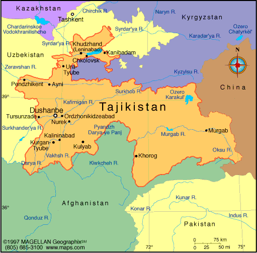
Anyone else think Tajikistan looks a bit like a cat or some similar animal?
 
More ugly than Tajikistan?
mtajik.gif


Edit: or Uzbekistan?
uzbekistan.gif

Tajikistan isn't that bad IMO, at least the borders look natural and wavy.

Uzbekistan on the other hand, well, straight line borders irk me with a passion. That's why I find the eastern states in the U.S. a lot more visually appealing than the western ones.
 
Personally i prefer the straight or gently curving borders to crazy things like the Tajiki/Uzbeki/Kyrgyz

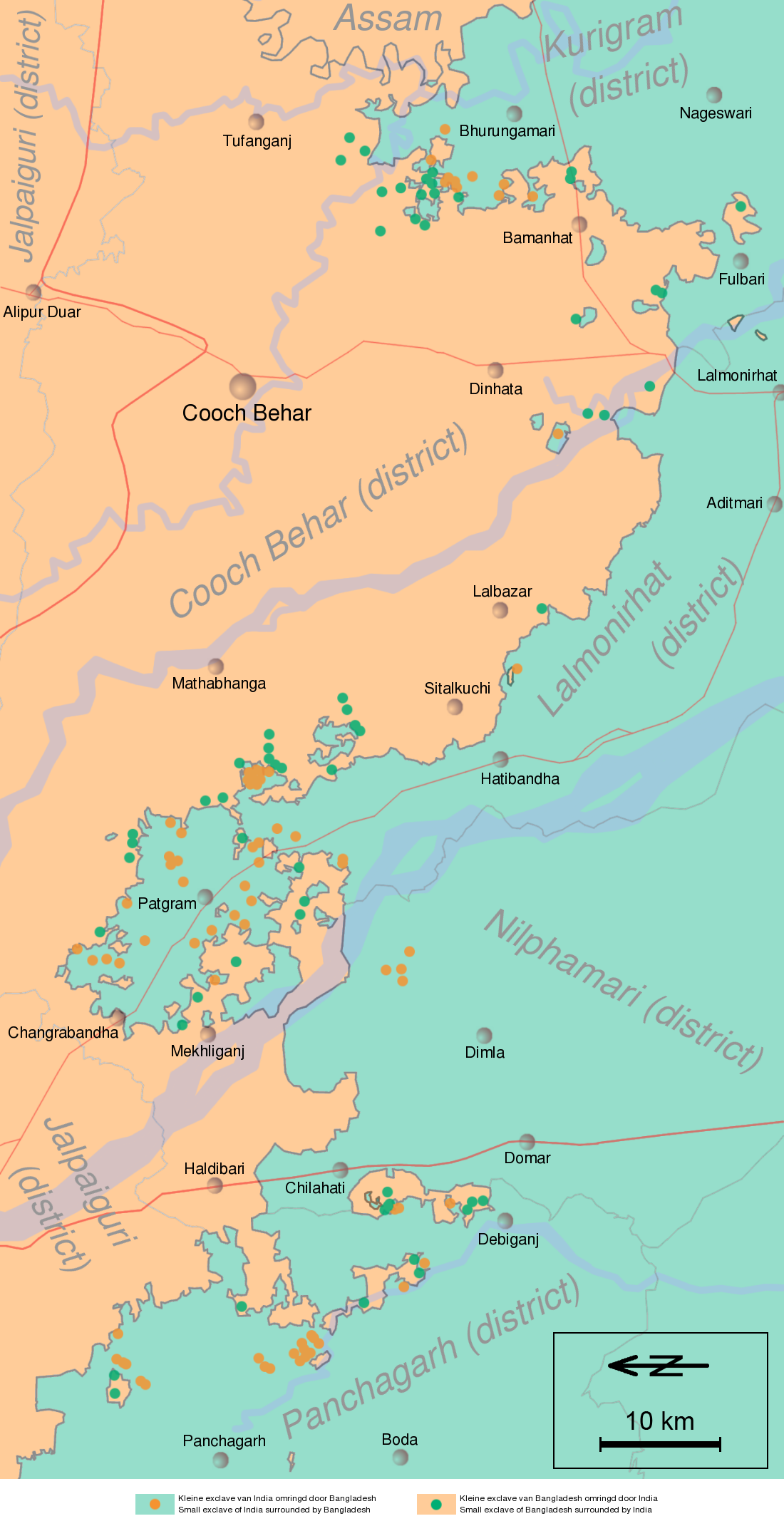
India and Bangledesh probably have the worst border if you get to a small enough scale.
Cooch-behar-enclaves-schematisch.png
 
Yeah, those borders do look ugly as hell, they're the extremity of wavy natural borders.
 
Yeah, those borders do look ugly as hell, they're the extremity of wavy natural borders.
They were drawn up by the British during the Partition. It's the conclusion of trying to draw borders up along ethno-religious lines (albeit using existing provincial borders as a basis) than any sort of "natural" evolution.
 
They were drawn up by the British during the Partition. It's the conclusion of trying to draw borders up along ethno-religious lines (albeit using existing provincial borders as a basis) than any sort of "natural" evolution.

By natural I meant more or less not straight, not that it has to do with nature (though natural things like rivers help!).
 
By natural I meant more or less not straight, not that it has to do with nature (though natural things like rivers help!).
Oh, I thought that by "natural" you meant borders that had been worked out over the course of centuries, like in Western Europe. My mistake.
 
heh heh cooch behar

heh

cooch

heh

that's what you get when you try to anglicize kochbihar
 
I see your Transnistria and raise you the Governorate of Giza

 
Just another reason why nobody recognizes them as an actual country. :mischief:
 
The name all but makes up for it.
 
A proposed partition of India (or "Dinia") by Chaudhary Rahmat Ali (the guy who coined the word "Pakistan")

Spoiler :
continent_of_dinia_and_its_dependencies.jpg


Features:
- Enlarged Pakistan, including all of Kashmir and all of Punjab up to Delhi, except for a state reserved for the Sikhs, and parts of Gujarat.
- An enlarged Bangladesh ("Bang-i-Islamstan") including all of Bengal and most of Assam, and separate from Pakistan.
- Osmanistan, created from the State of Hyderabad, then ruled by a Muslim ruler with a significant Muslim minority (said ruler in fact did try to establish an independent state; it took an Indian invasion to depose him and forcibly annex Hyderabad into India).
- Various Muslims enclaves within Hindu India, as well as two homelands for Sri Lankan Muslims.
- Laccadive Islands renamed to Alam Islands, and Andaman and Nicobar Islands to Ashak and Balus Islands.
- Rest of India marked with names of regions (eg Dravidia, Andhra); these can possibly become independent states too.
- The seas around India renamed after the Muslim states, perhaps to honour Muslim merchants in maritime trade.
 
Found a map which is bit which is a little clearer.
MAPOFRAHMATPLAN.jpg


The oddest bit has to be the Muslim land in Sri Lanka taking being so large when only 8% of people are muslim.
 
How terrible history would have been if such a plan succeeded.

All the Sikhs seem to have no say of where they will live.
 
Status
Not open for further replies.
Back
Top Bottom