Altered Maps XIV: Cartographical Consistency

Still, you know, MIT.

Ghosts of information:
http://pantheon.media.mit.edu/vision

You were not born with the ability to fly, cure disease or communicate at long distances, but you were born in a society that endows you with these capacities. These capacities are the result of information that has been generated by humans and that humans have been able to embed in tangible and digital objects.

This information is all around you. It is the way in which the atoms in an airplane are arranged or the way in which your cell-phone whispers dance instructions to electromagnetic waves.

Pantheon is a project celebrating the cultural information that endows our species with these fantastic capacities. To celebrate our global cultural heritage we are compiling, analyzing and visualizing datasets that can help us understand the process of global cultural development. Dive in, visualize, and enjoy.
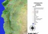
 
Florida's handle is in the wrong place.
 
I can't help but imagine making oddly-shaped omelettes or fried eggs in some of the smaller states.

EDIT: After reading the below, I think my phrasing needs work!
 
Soon: British paratroopers landing in New England. Reason? "We were making omelette." More at 11, only on Fox News
 
A map created by me as a part of my doctorate :) It shows coastal Syria in 10th and 11th century :)
 

Attachments

  • Centralna Syria.jpg
    Centralna Syria.jpg
    533.7 KB · Views: 146
Coming back to discussion from page 47:

This also refers to stories about the Great Flood.

https://en.wikipedia.org/wiki/Storegga_Slide

The three Storegga Slides are considered to be amongst the largest known landslides. They occurred under water, at the edge of Norway's continental shelf (Storegga is Norwegian for "the Great Edge"), in the Norwegian Sea, 100 km (62 mi) north-west of the Møre coast, causing a very large tsunami in the North Atlantic Ocean. This collapse involved an estimated 290 km (180 mi) length of coastal shelf, with a total volume of 3,500 km3 (840 cu mi) of debris.[1] This would be the equivalent volume to an area the size of Iceland covered to a depth of 34 m (112 ft).

Based on carbon dating of plant material recovered from sediment deposited by the tsunami, the latest incident occurred around ~6225–6170 BCE (...)

(...)

At, or shortly before, the time of the last Storegga Slide, a land bridge known to archaeologists and geologists as "Doggerland" existed, linking the area of Great Britain, Denmark and the Netherlands across what is now the southern North Sea. This area is believed to have included a coastline of lagoons, marshes, mudflats, and beaches, and to have been a rich hunting, fowling and fishing ground populated by Mesolithic human cultures.[6][7][8]

Although Doggerland was physically submerged through a gradual rise in sea level, it has been suggested that coastal areas of both Britain and mainland Europe, extending over areas which are now submerged, would have been inundated by a tsunami triggered by the Storegga Slide. This event would have had a catastrophic impact on the contemporary Mesolithic population, and separated cultures in Britain from those on the European mainland.

https://en.wikipedia.org/wiki/Viking_Bergen_Island

A more recent hypothesis is that much of the land was inundated by a tsunami around 8200 BP (6200 BC), caused by a submarine landslide off the coast of Norway known as the Storegga Slide. This theory suggests "that the Storegga Slide tsunami would have had a catastrophic impact on the contemporary coastal Mesolithic population. [...] Following the Storegga Slide tsunami, it appears, Britain finally became separated from the continent and, in cultural terms, the Mesolithic there goes its own way."
 
I used QGIS. In the times of crusades:
- Hama became much much more important
- Apamea became less important
- Qinnasrin was deserted completely
- many new forts were built
- Antarados (Tortosa, Tartus) became much more important
etc
 
Are they from those places, or?
Spoiler :

Also, London once again looked like Poland
 
Top Bottom