You are using an out of date browser. It may not display this or other websites correctly.
You should upgrade or use an alternative browser.
You should upgrade or use an alternative browser.
The Ultimate Map Thread
- Thread starter Abaddon
- Start date
Silver Steak
The Ghost of SS
Just curious, but what's the common way of tweaking with maps among MODs? I assume the most common tool is good ol' MSP, but I've noticed that some have upped some maps that look "generated" with more advanced software. I'm very fond of maps that are pleasing to the eye and have poked around a bit to find ways to make it easier for both MODs and players alike.
The technique I'd like to recommend is to use multi-layered maps in GIMP. Now, I know this is by no means a revolution - I expect some MODs to have adopted it long ago and use it regularily. Still, since GIMP is free to download, there's no reason to combine the layers to export it when the update is finished. The MOD can simply upload the multi-layered map for the players to download and open. Better still, both methods can be used for quick overview while reading the update and deeper study later on when planning orders.
Allow me to demonstrate with the map below of a setting I was tweaking around with. By simply toggling the view button in the Layers window, you can switch between terrain view and map view, toggle cities, roads and borders, all according to how you prefer to observe the situation. This could easily be expanded to add units, trade routes, notable battles as well as record former borders. The possibilities are nearly endless, and may add to or replace stats and modifiers such as trade centers, alliance overviews, religions etc.
The best part about this is that GIMP is hardly any more advanced than MSP. Sure, it's got heaps of tools, but for NESing, it's like MSP with the option of multiple layers. What do you guys think? I sure hope I'm not the only one cringing when I open a NES thread to find that the map looks beyond hideous.
YOU CAN INSTALL GIMP FOR FREE HERE: http://www.gimp.org/downloads/
Attachments
Silver Steak
The Ghost of SS
It could be used for applying shrouds to maps as well. The only issue is that the MOD needs to apply it directly on the map layers by making copies of the shroud and merge it on top so that the players cannot untoggle the shroud to see the entire map. With a fuzzy brush, it can make for some visually pleasing and intriguing maps. ")
Attachments
Well, the problem with keeping layers is that you're assuming people have a compatible program to view the files. For example, Paint.NET saves files as a .pdn format, Photoshop uses .psd, and The GIMP has .xcf, so you would basically require all players to have the same program in order to play.
Also, for Earth-based NESes, players can easily look up climate, terrain, etc., while non-Earth-based NESes can typically get by with having those maps on the front page.
Also, for Earth-based NESes, players can easily look up climate, terrain, etc., while non-Earth-based NESes can typically get by with having those maps on the front page.
Silver Steak
The Ghost of SS
I'm simply suggesting to upload maps with layers in addition to standard .png for quick reference when reading the update. Like I said earlier, GIMP is free and easy to install. It's simply an extra service for those who are interested in having a more detailed overview. (If I were to MOD, I would likely add layers for religion/culture and not make stats in the thread.)
As for Earth Fresh Starts, I agree that any player can look up climate and terrain easily. But that hasn't stopped said NESes from being successful. Even if you know what's there, you still need to explore it and found colonies/settle.
As for Earth Fresh Starts, I agree that any player can look up climate and terrain easily. But that hasn't stopped said NESes from being successful. Even if you know what's there, you still need to explore it and found colonies/settle.
Ninja Dude
Sorry, I wasn't listening...
It could be used for applying shrouds to maps as well. The only issue is that the MOD needs to apply it directly on the map layers by making copies of the shroud and merge it on top so that the players cannot untoggle the shroud to see the entire map. With a fuzzy brush, it can make for some visually pleasing and intriguing maps.
That's quite the familiar map you got there
")
Anyways, I'm getting the hankering to make a GodNES style map for some reason. If the urge gets strong enough I might post the results here. Any specific terrain types or something any of you would like to request so I can actually have something specific to focus on?
Cobalt Command
Destroyer of Worlds
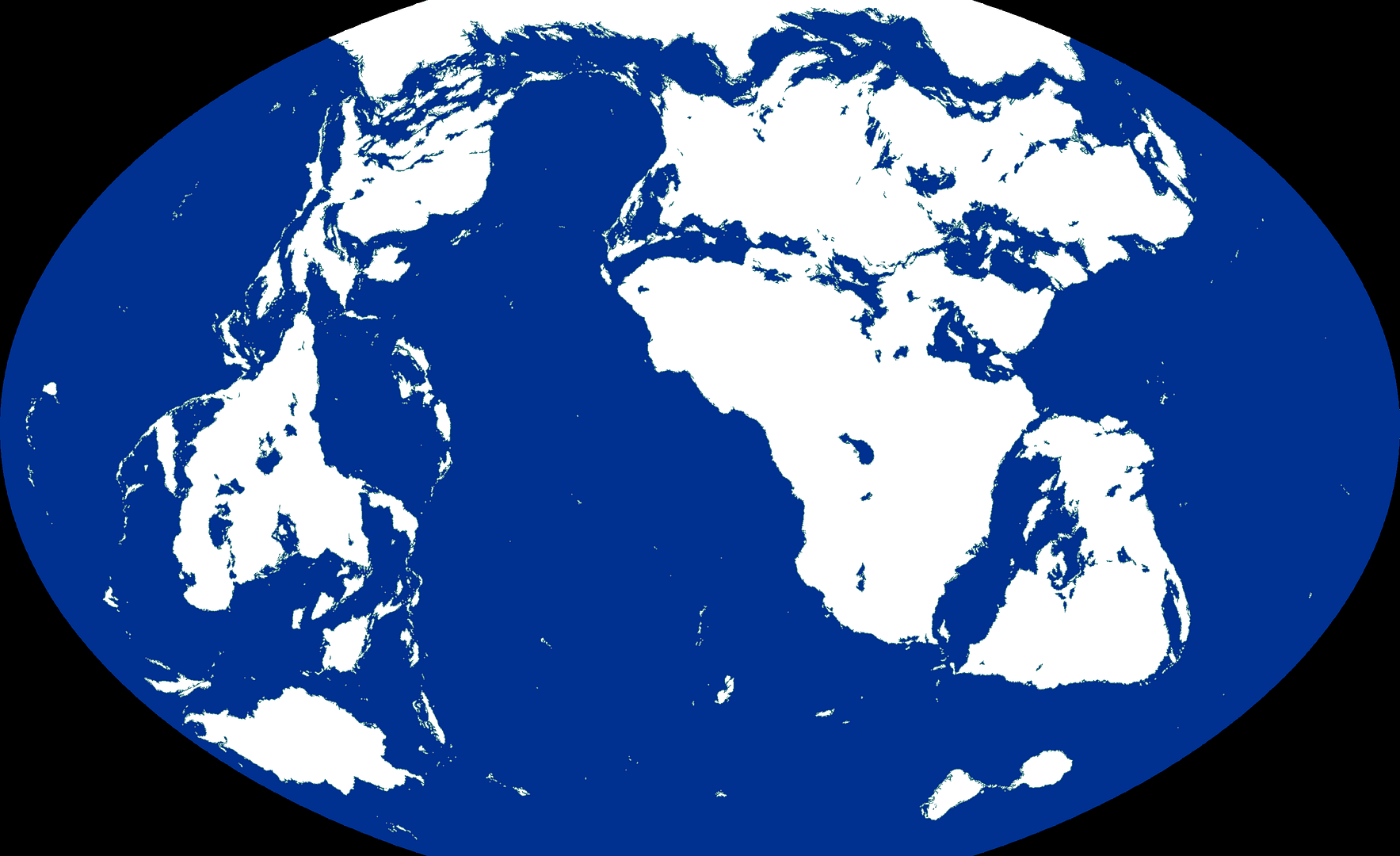
Someone should totally take this, clean up South America's rivers, get rid of that yellow in the North Atlantic, and make a Fresh-Start NES.
I do not claim creation of this map.

I do not claim creation of this map.
Spoiler :
Cynovolans
Not in my dimension.
I love those maps, though I wish there were more maps of the Middle Ages.
Silver Steak
The Ghost of SS
That's quite the familiar map you got there
Anyways, I'm getting the hankering to make a GodNES style map for some reason. If the urge gets strong enough I might post the results here. Any specific terrain types or something any of you would like to request so I can actually have something specific to focus on?
You could always try to make something with a crystal/glass theme.

Daftpanzer
canonically ambiguous
This was for Matt0088's old NES and is no longer needed. Posting here just in case its useful to anyone (non-Earth world).
Spoiler :
Shadowbound
Incorrugible
- Joined
- Mar 4, 2007
- Messages
- 4,079
Is there a climate map for that?
Daftpanzer
canonically ambiguous
Is there a climate map for that?
No, I never got that far. I did do some rivers, though probably not up to standards, and of course that ties into the kind of climate you want. Theres also issues around the edge of the map, an ugly pixel pattern appeared. The colour of the water/land border is one thing that is very easily changed.
Haseri
Emperor
Ooo, ver' nice.
Why'd you reverse it east-west Daft?
One that's 5% done, so there's no reason to give it out, you could get as far as is shown on it in about a half hour. Me and Daft both worked on rivers throughout the map however, and I have a decent amount of mountains NK style on one version as well.
Is there a climate map for that?
One that's 5% done, so there's no reason to give it out, you could get as far as is shown on it in about a half hour. Me and Daft both worked on rivers throughout the map however, and I have a decent amount of mountains NK style on one version as well.
Daftpanzer
canonically ambiguous
Why'd you reverse it east-west Daft?
I wanted to change from my usual thing of having america-type continents in the east
Shadowbound
Incorrugible
- Joined
- Mar 4, 2007
- Messages
- 4,079
As opposed to everyone else's usual thing of having America in the west?
Similar threads
- Locked
- Poll
- Replies
- 11
- Views
- 2K
- Replies
- 50
- Views
- 7K