Altered maps IZ: gib clay!

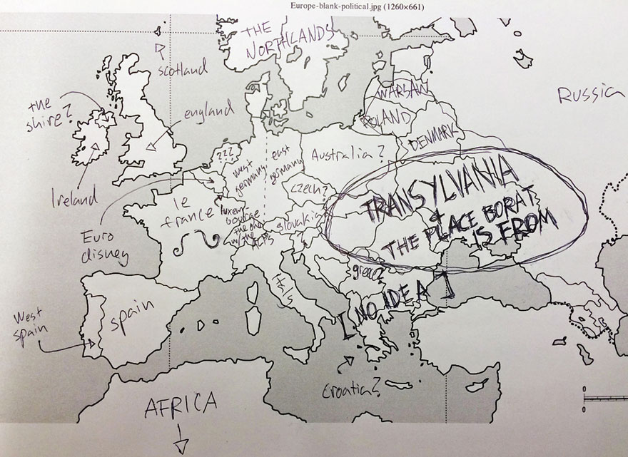
Shoutout to Iratlantis. The lost nuclear continent in the middle of the Indian Ocean.
 
Also known as Ryleth.
 
this legendary mythical story has American high schoolers unable to find Mexico on the map .
 
I take this is an exam paper or whatever on which schoolchildren identify countries ? The Shire is of course wrongly placed or something as if ı were to find a reference it would turn out to be some rural England where Tolkien could drive to without crashing on the way , reportedly a terrible driver . Yet ... oh wait , the dotted thing is where Europe is seperated from Asia .


They forgot to mention it has more or less the population of Romania ;)

Also, the last comparison seems rather ridiculous, as does the "Europe" (what is it? It's not the Eu, and it isn't the continent either; seems to be roughly 2/5ths of the continent...)
 
Last edited:
What an odd picture: Yugoslavia and Czechoslovakia are both broken up (meaning this map was made after 1993) but the Soviet flag is on there... and communist Romania... twice.

It seems whoever made this just couldn't bother to do more than copy-paste already made rows of flags. It is why you also see the flag of countries not there on the maps, eg Sweden and Norway :)


I was looking for a graph node map of Europe, using number of neighbor states, but a quick google provided no result (I am sure there are maps, just didn't find it by looking for Europe map + graph node) so this will have to do :p 
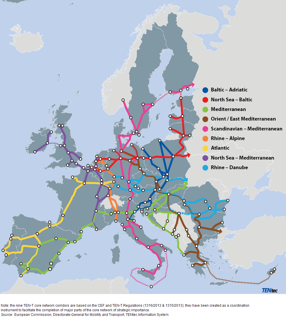
(it is major transport network nodes)

I am not sure why there is an intersection in Jutland, but no node. Should be Aarhus anyway.
 
It isn't altered, but I found it interesting.

map.jpg
 
Top Bottom