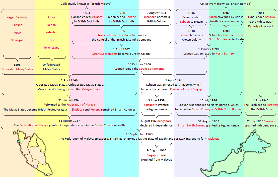
Winner
Diverse in Unity
Do you think the Mercator Projection would fall out of favour if Europe still dominates the world? I think not.
I think yes. It is not used now because we've generally moved to projections that better represent reality.
Do you think the Mercator Projection would fall out of favour if Europe still dominates the world? I think not.

Weird country.
---
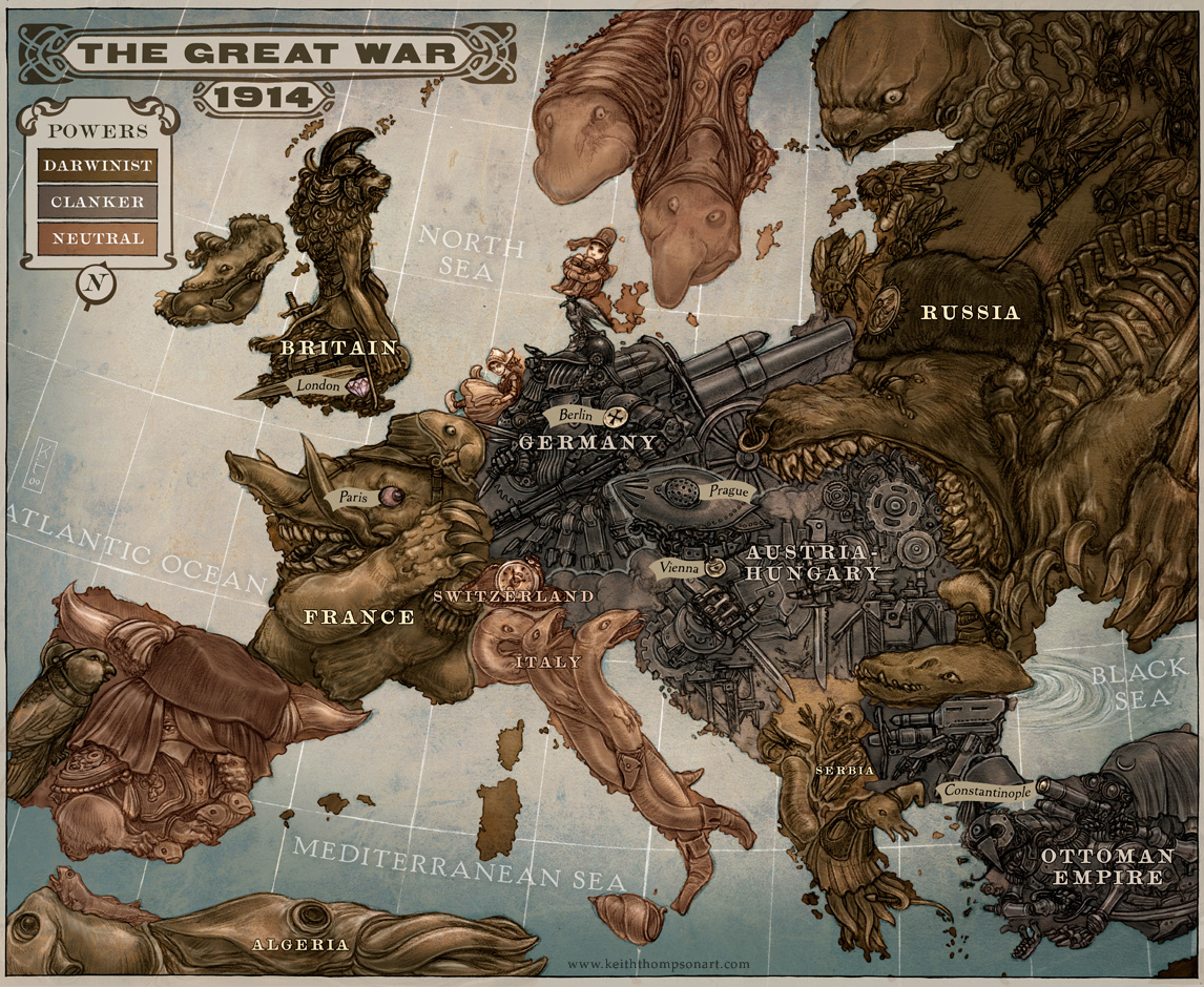
This also isn't exactly a map:
Never - Oder-Nise line
Vote CDU
When was this poster made, and whats wrong with CDU?
I guess it's very old, probably from the early post-WW2 era, before FRG gained independence.
FRG only recognized the Oder-Nise line as the eastern border of Germany during reunification in 1990, if I remember correctly.
The Treaty of Warsaw was an important element of the Ostpolitik, put forward by Chancellor Brandt and supported by his ruling Social Democratic Party of Germany. In the aftermath of the 1990 Treaty on the Final Settlement with Respect to Germany, the Oder-Neisse line was reaffirmed without any reservation with the German-Polish Border Treaty, signed on 14 November 1990 by re-united Germany and Poland.
If West Germany wasn't independent, why would anybody be voting for the CDU?The map shows occupation zones, so it must be from before West Germany regained independence.
If West Germany wasn't independent, why would anybody be voting for the CDU?
")


 )
) we're a piece of paper