You are using an out of date browser. It may not display this or other websites correctly.
You should upgrade or use an alternative browser.
You should upgrade or use an alternative browser.
Map: 2008 Presidential Election Results, County by County
- Thread starter Quasar1011
- Start date
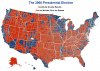
I see two counties in that picture that are neither red or blue.
GenMarshall
High Elven ISB Capt & Ghost Agent
Holy crap!! Is that a Purple County I see in Colorado.
I see two counties in that picture that are neither red or blue.
50/50 split I'd assume.
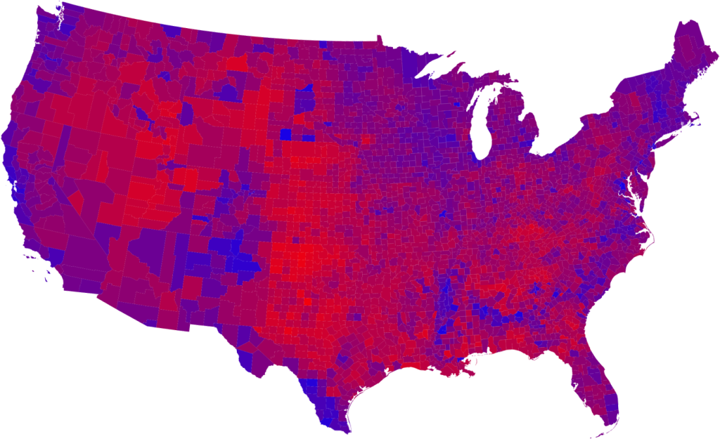
I prefer purple America. I really like how in some areas you can't tell where one state ends and another begins (Ohio / Indiana; Texas / Oklahoma panhandle for instance) and in other cases, can clearly see state lines (New Mexico / Texas & Oklahoma).
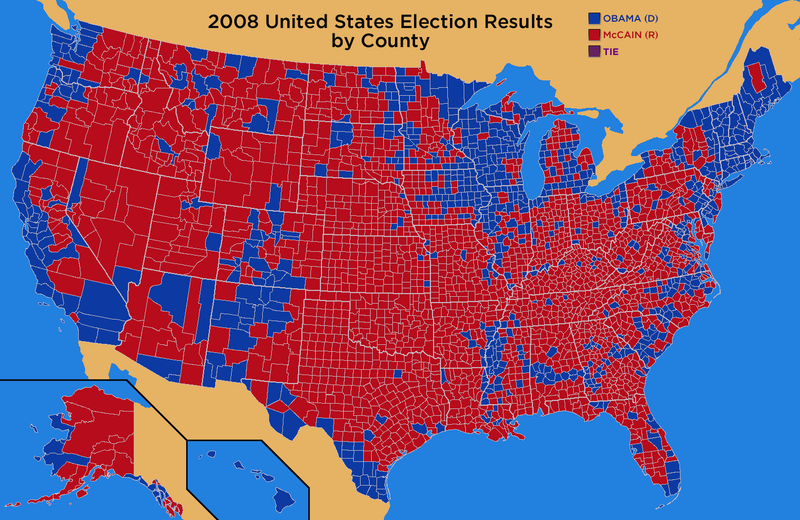
The east-west band of blue that runs from Miss to Georgia seems fascinating to me. I'd have to wager that's a concentration of black voters, but what unites them on that band. Is it a river?
It's the foothills (or lower foothills, rather) of the Appalachian Mountains - from Maryland to Arkansas.
It's the foothills of the Appalachian Mountains.
I thought the Apps ran north/south?
I thought the Apps ran north/south?
Along the east coast, yes, but it has a wide southern base.

Note how the blue wrapped around the mountains in Alabama.
(Then there's the brief east-west run in Pennsylvania)

It doesn't look like the Republicans are much in danger of becoming a regional party to me (even in augurey's map)...
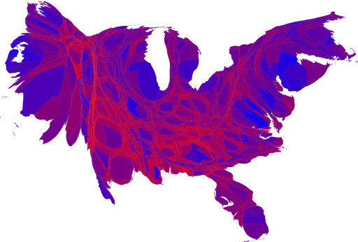
Individual counties are not the same as population. Democrats won big in the urban areas and won the suburbs. Republicans win big in rural areas. Rural areas are less populous.
Well, since we apportion electoral votes by population instead of per acre, they pretty much are right now.It doesn't look like the Republicans are much in danger of becoming a regional party to me (even in augurey's map)...
Yes to you both, but the definition of a national party is one that is relevant geographically, not one that necessarily wins elections. If anything, the reps are more relevant in the dem strongholds than vice-versa. Clearly there is significant support for the republicans even in the NE and the West, even if ultimataly that support is neutralized by urban areas.

Yes to you both, but the definition of a national party is one that is relevant geographically, not one that necessarily wins elections. If anything, the reps are more relevant in the dem strongholds than vice-versa. Clearly there is significant support for the republicans even in the NE and the West, even if ultimataly that support is neutralized by urban areas.
As of the last election, there is not a single Republican member of the House of Representatives from New England.
And the Republican support isn't "neutralized" by the urban areas, it's completely overwhelmed by it. Obama won New York State by about 1,800,000 votes (62% to 37%). He won New York City by about 1.4 million votes. There are so many more people in the small blue areas, you simply can't compare how "red" or "blue" certain counties are.
Cleo
Ansar
Détente avec l'été
Pretty interesting.Along the east coast, yes, but it has a wide southern base.
Note how the blue wrapped around the mountains in Alabama.
(Then there's the brief east-west run in Pennsylvania)
")
aronnax
Let your spirit be free
Wow, two democratic counties in Nevada can outvote 13 Republican counties
Politics is fun!
Politics is fun!
Yes to you both, but the definition of a national party is one that is relevant geographically, not one that necessarily wins elections. If anything, the reps are more relevant in the dem strongholds than vice-versa. Clearly there is significant support for the republicans even in the NE and the West, even if ultimataly that support is neutralized by urban areas.
Okay so when there are no Republican representatives in New England, and 26-3 D/R in New York, how is it significant support?
As far as the band of blue running through the south, I saw this stumbling around the internet last night:
http://cstl-csm.semo.edu/gathman/cottonvote.htm
(That is a professors website from Missouri State)
http://cstl-csm.semo.edu/gathman/cottonvote.htm
(That is a professors website from Missouri State)
Similar threads
- Replies
- 2K
- Views
- 71K
- Replies
- 1K
- Views
- 48K
- Replies
- 0
- Views
- 1K
- Replies
- 73
- Views
- 3K