Redraw the States!

Good lord, don't do that. East Virginia already looks like a mess with it's "Free Cities".
 
The eastern coast seems to be Irish-American dominated:

Especially the Chathair Saor Filideilfia (Free City Philadelphia):

New_York.png


Wolne Miasto Czykago and Chathair Saor Filideilfia:

Chicago.png


So - is Poland in [North] Africa or in Mexico ???

======================================

Nuova York Bologna:

NYC.png
 

Attachments

  • New York.png
    New York.png
    462 KB · Views: 57
  • NYC.png
    NYC.png
    186.2 KB · Views: 59
  • Chicago.png
    Chicago.png
    181.3 KB · Views: 43
So you say Poland is both everywhere and nowhere at the same time?

Well, at least in case of New Ireland its location is more precise:

Ireland.png


======================================

But what happened to the Italians of Louisiana?:

Italy.png
 
Whoever mentioned ethnicity in this thread: thanks. Thanks a lot.
 
Yeah the racial makeup maps are depressing, especially when you look at big cities like Detroit, Chicago, LA, Seattle, and NYC and see how damn segregated they are. Then there's states that are just 97% white people and it's bizarre.
 
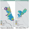
Yeah but that map shows pluralities, not majorities. So, for example, your 'West Africa' would probably still have a hefty white majority. Its whites are just divided between German, English, Irish, 'American,' and so on. And there's little difference between German Americans, English Americans, etc and most other types of white American which really makes the divisions along these lines kind of pointless (not that dividing the country along ethnic lines would be a particularly good idea anyway, but I'm sure you know that).
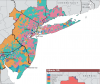
Yeah, I realize all these things.

I just know how much you guys love ethnic segregation and gerrymandering, so I downloaded U.S. census data, combined both ideas and took it one step further. It's not meant to be realistic. edit: It's ein joke!
 
Nobody annexed Canada in their map yet? Mexico?

How many states / senate seats would you give them?
 
Good lord, don't do that. East Virginia already looks like a mess with it's "Free Cities".

Guaranteeing the cities a voice in the state-level government does have an advantage, though, because otherwise nobody is seriously addressing urban issues.

Nobody annexed Canada in their map yet? Mexico?

How many states / senate seats would you give them?

Canada ought to be annexed, but we are too lazy to redraw the maps so they are safe at the moment.

I would definitely add Puerto Rico and a state comprised of all the inhabited territories in the Pacific (or add them to Hawaii?). Probably wouldn't mess with the internal US borders too much, that can lead to some unintended consequences. I would add about 400 seats to the House, though, and do non-partisan redistricting commissions in every state.
 
34 states, 1 federal district

e4ZYfGD.png


- The enlarged District of Columbia would have limited self-government
- House seats allocated in proportion to State(+DC) population
- Each state gets 5 senators instead of 2, with DC electing one senator acting as tie-breaker
- Presidential elections now decided by popular vote
 
Not bad, but not necessary to keep Mass. distinct. Roll it in with New England. Also, can you change Kansas to Nebraska? Kansas that large is making me develop a tic.
 
Not bad, but not necessary to keep Mass. distinct. Roll it in with New England. Also, can you change Kansas to Nebraska? Kansas that large is making me develop a tic.

Given the structure of the Senate, I'm wondering how all these mergers would affect the partisan balance and if it levels out the population problem.

And TK beat me to the punch on Kansas. :)
 
Back
Top Bottom