CELTICEMPIRE
Zulu Conqueror
I think this map has been posted before.

")
One day in the 13th century...


Meh, it's complicated. See, in our language, it's like this:
Čei (Czechs) means either A) citizens of the Czech Republic/people who speak Czech, or B) Bohemians, inhabitants of Bohemia. The terms Bohemia/Bohemians are of Germanic-Latin origin and we don't use them, except in the sense "bohemian" (bohém in Czech).
Thect Sammungen (Geography of "The North")(Translated to English)
Following an apocalyptic pandemic that killed every person on the main continents, northern tribes as well as inhabitants of Greenland and Svalbard have slowly developed over the past thousand years. With little in terms of resources, many factions continue to exist.
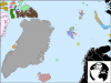
Svalbard is quite a forested area, and has fractured into four distinct states. Koukyuk, the one depicted in red, has the largest supply of iron in The North. It remains a powerful buffer for the Akyuk (blue) and So-Da (red) city-states, which warred constantly for 500 years but have since withdrew from combat since the Koukyuk people learned to refine iron. So-Da and Akyuk have vast quantities of rare-earth metals and coal, of which they trade to Koukyuk for iron. Salmat (green) remains profitable; some of its outer northern islands function as crucial hubs, establishing trade between the city-states of Svalbard (now known as Dukcha) and Franz Josef Land (now known as Moeitos).
Unlike the aggressive Dukchan city-states, Moeitan governments are best described as confederacies. Tos (green), Yal (blue) and Pugni (orange) are barely coherent city-states by themselves, and the people inhabiting these islands are isolated, almost completely. However, the conglomerate lies above a supervolcanic system, and many volcanoes supply the city-states with precious quantities of obsidian, which has increased their agricultural output dramatically over the past 750 years. The fresh lava also encourages fierce trade with Koukyuk for iron, but their lack of wood (which Dukchan nations will not trade) prevents them from seeking more commercial ventures.
To the east of these archipelagos, tribes remain uncivilized. It is useful to know that the North and South Mangans (grey and blue) are able to sustain and harvest the population of deer that remains there. The deer specifically eats otherwise inedible moss that grows rapidly on the stone covering the large island. Because no wood or metals exist on the vast island (only stone and deer materials), wars are sporadic and primitive. A difference between North and South Mangan is that, over a period of 800 years, South Mangan has experienced a favorable jet stream that increases temperatures in the area to around 58F (14C) during summer (quite warm at this latitude). All other islands, like Cancas (green, dual, top), Rlal (blue, top right), and Flal (yellow, right) are sparsely inhabited and poorly organized.
Ganmungen (Bear Island), however, has a plethora of resources to use. They, experiencing the same jetstream as the South Mangan peoples, experience extremely warm weather (70F, or 21C) and possess a variety of fruits, such as coconuts and mangoes. They can also harvest wood from the trees, and expeditions to Dukcha are not uncommon. These fruits, a luxury, are traded to Dukchan merchants for high prices. To wealthy Dukchans, Ganmungen is a vacation area. They are the leaders of technological research of The North, and, at present (3047AD), have the highest population of The North, at 1,253,801 persons (total popluation of The North est. 2,849,932).
In 3045AD, a new area was suspected to be found, past the desolate Bolka (Greenland) and Chalka (Iceland). Their civilizations appeared extremely complex, according to a scout ship sent back to us--the main convoy, however, seemingly disintegrated. Ganmungen will be performing a second expedition later this year.