Love
Deity
Most towns are a bit wrong.


This is, from what I know, all the territories that Spain has had throughout history in Europe:
Spoiler :
 Thanks... Or another world map from 1980 would be nice too
Can somebody remove the colors from this map while keeping the borders? I tried and screwed it up
http://upload.wikimedia.org/wikipedia/commons/f/ff/Cold_War_Map_1980.png
Here, Like this?
Can't be assed to correct either you or silver on nitpicky nonsense in a postcountless threadI'm sure Dachs or someone will tear up that map and everything I had to say later.
Lactose intolerance!
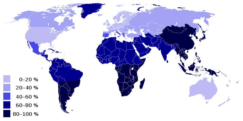
God damn I love being from Northern/Central Europe.
I have English heritage and yet I am lactose intolerant.
I hope so or my parents, sister and I are the only British people in the world!I'm going to assume there is 5 or more people of English heritage in the world.


